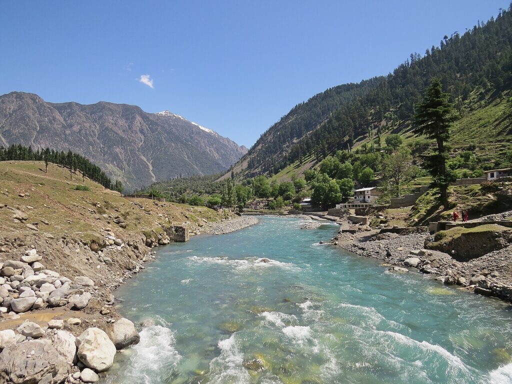
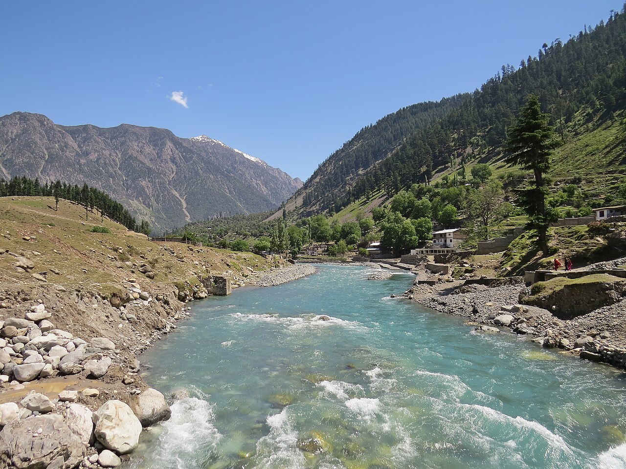
Cover photograph: Swat River and green hills viewed from the main bridge at Kalam. Akbar Ali Asif (Akbar Asif22) / Wikimedia Commons · CC BY-SA 4.0. Resized for display; the cover may be cropped.
Crossroads field guides · Khyber Pakhtunkhwa · Valley and heritage
Swat offers Buddhist archaeology, settled river valleys, forested hills and higher mountain excursions. The places are not interchangeable: a museum visit in Saidu Sharif, a Kalam stay and a Mahodand approach require different time and transport. This guide explains the distinctions while keeping current travel advice visible.
By Sultan Uddin · Crossroads Adventure · Editorial review: 4 October 2026
Read the access situation first
Swat lies in Khyber Pakhtunkhwa. At this review, the UK advises against all travel to Swat, and the US advisory identifies KP as a Do Not Travel area. Those warnings should not be replaced by a general claim that “tourists are always safe.” Check your government’s advice, local permission requirements and insurance before planning.
This article explains the destination; it is not a clearance to travel. A locally available hotel or road does not establish that your nationality, insurer or circumstances permit the journey. Review official regional advice and the US Pakistan advisory.
Mingora, Saidu Sharif and Buddhist heritage
Swat Museum
Use the museum as an introduction to the valley’s Gandhara heritage before visiting archaeological places. Check opening arrangements directly, and allow time for interpretation instead of using it as a brief stop between drives.
Butkara and the Jahanabad Buddha
Buddhist remains and the Jahanabad rock carving help explain Swat’s historical importance. A guide can distinguish periods, restoration and surviving features. Access may involve uneven surfaces and local approaches that do not suit every visitor.
Marghazar and the White Palace
Marghazar offers a lower-valley change of setting. Verify what is open and how the property is used before assuming unrestricted interior access. Pair a visit with time for the valley rather than several distant mountain sites on the same day.
Bahrain and Kalam
Bahrain is a useful place to understand the transition into the upper valley. Kalam sits beyond it and is the starting point for several excursions. Market traffic, road repairs and weather can make a modest map distance take considerably longer than expected.
The PTDC booklet gives Kalam at roughly 7,000 ft, or about 2,130 m. This is a rounded settlement reference, not the elevation of every surrounding lake or resort. Spending a night there does not establish readiness for any higher objective.
When access is appropriate, allow separate days for the lower valley, the transfer to Kalam and a selected upper-valley excursion. A four-to-six-day outline is a Crossroads pacing suggestion, not a promise that all tracks will be usable. Avoid adding a long return transfer immediately after a demanding lake day.
Mahodand, Ushu and Utror
Mahodand Lake
The Mahodand approach passes beyond the Kalam and Matiltan corridor into rougher mountain access. PTDC describes the lake as about 23 km beyond Matiltan, which is a location reference rather than an estimate of driving time. Track conditions determine the appropriate vehicle and realistic duration.
Ushu Forest
A permitted forest walk can provide a gentler alternative to a long lake excursion. Discuss an appropriate trail and distance with a local guide, and respect land use rather than wandering into private areas.
Utror Valley
Treat Utror as a distinct excursion with its own road assessment. Do not combine all upper-valley directions simply because they are grouped under Kalam on a blog map. A short list of well-paced places often creates a better experience.
Malam Jabba and other lower-effort choices
| Place or activity | Main appeal | What to confirm |
|---|---|---|
| Malam Jabba | Mountain resort setting and seasonal activities | Road access, resort opening, lift operation and snow conditions |
| Museum and heritage sites | History and archaeology | Hours, guides, steps and conservation restrictions |
| Valley walk | Landscape and everyday life | Permitted route, surfaces, distance and privacy |
| Lake excursion | Higher mountain scenery | Track condition, vehicle, weather and return time |
Skiing, chairlifts and other activities depend on operator schedules and conditions. A winter photograph does not mean snow sports run year-round. Ask about instruction, suitable equipment and the activity provider’s rules rather than assuming everything is included in a private itinerary.
Season, comfort and route planning
Lower and upper Swat have different weather. Summer may favour higher excursions after tracks clear, while winter can bring snow and closures. Rain may damage access at any time. Use PMD weather information and a current local road report instead of a fixed promise about opening dates.
Pack walking shoes, rain protection, layers and water for the selected outing. For families and older visitors, agree toilet stops and the amount of rough-road time before leaving. A premium hotel base does not make every surrounding track comfortable.
Keep riverside stops away from unstable banks, do not enter unfamiliar water and follow photography rules at religious and heritage sites. Check permits before fishing. A guide should advise when a short walk is preferable to a difficult excursion.
For regional context, read our historical places guide and rivers guide. For alternative northern planning, compare destination choices and seasonal hiking guidance.
Frequently asked questions
How many days should I allow for Swat?
When travel is appropriate and access permits, four to six days can separate lower-valley heritage, the Kalam transfer and an upper-valley outing. Shorter visits should cover fewer areas.
Is Mahodand an easy car excursion?
Its approach can require a locally suitable vehicle and several hours on mountain tracks. Confirm the current road and do not infer time from kilometres alone.
Is skiing available at Malam Jabba throughout the year?
No seasonal activity should be assumed available year-round. Check the resort’s current operating arrangements.
Can this guide confirm that Swat is safe for me?
No. Check current government advisories, permissions, local conditions and insurance for your circumstances before making commitments.
People · Places · Purpose
Plan a journey around your interests
Tell us your dates, starting point and preferred pace. We will discuss a private route with realistic travel days and appropriate local support.
Discuss your private journey →Sources and updates
Geographical and historical references are linked below. Suggested pacing and travel allowances are Crossroads planning guidance. Reconfirm road access, permissions, opening times and prices before travel.