Crossroads field guides · Pakistan trekking guide · Routes & preparation
This Pakistan trekking guide compares the country’s major mountain routes, from K2 Base Camp, Gondogoro La and Snow Lake to Hunza, Nagar, Chitral, Kaghan, Swat and Kashmir. The best hiking trails in Pakistan are those that suit your experience, available days and comfort with altitude and remote camps. Use the regional route notes below to choose an objective, then build a camp-by-camp itinerary with realistic access and contingency days.
By Sultan Uddin · Crossroads Adventure · Editorial review: 5 October 2026
Compare Pakistan’s major trekking routes
Access check — 5 October 2026: This is a route-planning reference, not confirmation that every region is currently appropriate to visit. Check your government’s regional travel advice, local permissions and insurance before choosing a route.
Durations throughout this guide are approximate planning allowances, not guaranteed completion times. Unless stated otherwise, trekking-day ranges include the described return or traverse but exclude travel to the region, prior acclimatisation and reserve days. Distances labelled one way must be doubled for a return along the same route; GPS tracks can use different roadheads. Elevations are approximate, and a mountain summit is not a trek’s highest point.
Jump to a region: Karakoram glacier expeditions · Baltistan · Astore & Haramosh · Chitral & Ghizer · Kaghan & Siran · Swat & Upper Dir · Kashmir · Shorter hikes.
The first table introduces popular options; the regional sections below add the longer glacier traverses, Hushe and Astore routes, Hindu Kush journeys, and the lake and peak treks of KP and Kashmir.
| Route or outing | Start / gateway | Time to allow | Elevation context | Terrain and commitment |
|---|---|---|---|---|
| Selected village walks | Hunza, Nagar or Baltistan | A locally chosen 1–3-hour outing | Varies by village and viewpoint | Choose the actual path, surface and ascent; not every village path is easy |
| Ondra Poygah | Gulmit, Upper Hunza | 2–3 hours; about 2–3 km return | Viewpoint roughly 2,700–2,800 m | Sustained stairs; useful for walkers comfortable with climbing and descending steps |
| Ultar Meadows | Karimabad, Hunza | Allow 7–9 hours for a full outing; around 10–12 km return depending on start | Meadow roughly 3,270–3,300 m | Steep gorge and rough ground; consider an overnight plan rather than a rushed day |
| Rakaposhi Base Camp | Minapin, Nagar | 2–3 trekking days recommended; common return routes around 17–20 km | Selected base-camp area roughly 3,300–3,500 m | Large ascent and steep upper paths; campsite location affects the figures |
| Fairy Meadows and Raikot-side Nanga Parbat approach | Raikot Bridge, then local jeep and walking access | A multi-night stay is more realistic than a rushed day; base camp adds a substantial walking day | Raikot-side base camp commonly given around 3,967 m | The meadow, Beyal and base camp are different objectives |
| Patundas | Upper Hunza / Borith approach | 3–4 trekking days; common return lines roughly 24–30 km | Camp and ridge viewpoints roughly 4,170–4,300 m | Glacier crossing, steep ascent and altitude; technical support depends on conditions |
| Rush Lake | Hopar, Nagar | Allow 5–7+ trekking days with a gradual camp plan | Lake commonly reported around 4,660–4,694 m | Remote camping and glacier-related access; request the complete mapped distance |
| Batura Valley | Passu / Upper Hunza | A supported multi-day journey; choose the endpoint before agreeing a duration | Camp and pasture elevations vary by itinerary | Valley and pasture travel with route-specific glacier and water crossings |
| Shimshal Pass and Shuwert pastures | Shimshal village, around 3,100 m | Approximately 7–9 trekking days; add access, staging and reserve days | Pass around 4,735 m | Remote, exposed gorge paths and high camps |
| K2 Base Camp / Concordia | Skardu, then the Braldu approach | A multi-week expedition; official broad route guidance gives 14–20 trekking days | High glacier camps; confirm the highest point and each sleeping elevation | Many consecutive walking days, moraine, cold and expedition logistics |
For the detailed village, meadow and Nagar routes, see our short treks in Hunza and Nagar guide. For village outings and remote passes in Gojal, read the Shimshal Valley trekking guide.
This is a comparison of objectives, not a ranking from easy to hard. Snow, river levels, the exact route and team support can change the demands. Request daily walking hours, distance, ascent and sleeping altitude before deciding.
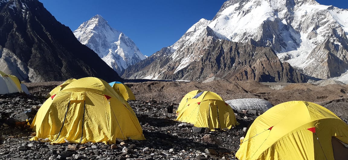
K2 Base Camp and Concordia
- Route & access
- Skardu → Askole / current Braldo roadhead → Baltoro camps → Concordia → K2 Base Camp → return
- Time to allow
- Plan an expedition-length programme; the existing comparison uses the official broad 14–20-day trekking allowance
- Elevation & distance
- Concordia around 4,600 m; K2 Base Camp roughly 5,100 m, with camp/route variations
- Usual season
- Generally June–September; settled high summer is commonly preferred
- Difficulty
- Very strenuous, with many consecutive camp and walking days
Best suited to: experienced walkers who can commit to consecutive camping days and have enough time for transport, acclimatisation and disruption. This is a full expedition choice, not a day hike added to a Skardu sightseeing stay.
The Baltoro journey requires a substantial expedition commitment. Skardu is the base for logistics, followed by the road approach through Baltistan and consecutive wilderness days. Walking involves uneven moraine and glacier-related terrain rather than a continuously maintained footpath.
GB Tourism gives a broad 14–20-day range for the K2 trekking experience. Total travel arrangements should add transport and contingency as needed. A return along Baltoro and a Gondogoro La crossing are different programmes; do not accept the latter as a simple optional stroll.
Ask about porter support, food, toilets, communications, rest days and emergency arrangements. A base-camp trek does not involve summiting K2, and the summit’s 8,611 m height must not be used as the trek’s maximum altitude.
Nanga Parbat and Rakaposhi approaches
These two base-camp areas belong to different approaches and should be evaluated separately. Rakaposhi is reached from the Nagar side; the Fairy Meadows route approaches Nanga Parbat from the Raikot side. A combined journey needs travel days between the regions.
Fairy Meadows and the Raikot side
- Route & access
- Raikot Bridge → local jeep stage → walking approach → Fairy Meadows → Beyal / base-camp objective
- Time to allow
- Allow 3–4 days locally for an approach, selected walk and departure; long base-camp day additional to approach
- Elevation & distance
- Fairy Meadows around 3,300 m; official Raikot-side base-camp figure about 3,967 m
- Usual season
- Normally May–September for the meadow; base-camp access needs a separate snow check
- Difficulty
- Moderate approach; strenuous full base-camp outing
Reaching Fairy Meadows involves a local jeep approach and a walk. A stay at the meadow is different from continuing towards Nanga Parbat Base Camp. Clarify the selected objective, expected day length and return schedule before assuming it suits a casual walker.
The official Fairy Meadows destination guide gives the Raikot-side base camp at approximately 3,967 metres. Its cited 4–5-hour approach is not a complete return-day allowance: add the descent, breaks, your pace and current conditions. A shorter Beyal or viewpoint outing may suit you better.
Rakaposhi from Minapin
- Route & access
- Minapin → Hapakun → Tagaphari / selected upper camp → return
- Time to allow
- Allow 2–3 trekking days rather than assuming a rushed one-day return
- Elevation & distance
- Upper camp roughly 3,300–3,500 m; common return routes around 17–20 km
- Usual season
- Usually June–September; confirm snow above Hapakun
- Difficulty
- Strenuous, with substantial ascent and descent
The Minapin-side route provides a focused mountain objective in Nagar. Steep ascent and descent can be demanding even when the total distance seems modest. A supported multi-day plan can be more comfortable than forcing a very long day. The roadside Rakaposhi viewpoint is a separate option for non-trekkers.
A Minapin-side plan may use Hapakun as an intermediate overnight stop before the upper camp area. Ask which camp is actually meant by “base camp,” whether the route crosses ice and how your luggage is transported. A smaller daypack and a supported camp can make the experience more manageable, but the ascent remains substantial.
For both areas, snow and seasonal services can affect access. A route that works in a settled summer period may not be a sensible late-autumn choice.
Rush Lake, Patundas and Batura
Rush Lake
- Route & access
- Hopar → guide-selected glacier crossings and camps → Rush Lake → return
- Time to allow
- Allow 5–7 or more trekking days, with camp spacing that suits acclimatisation
- Elevation & distance
- Lake approximately 4,660–4,694 m; Rush Peak is higher and separate
- Usual season
- Generally July–September; route and crossing conditions decide
- Difficulty
- Strenuous; altitude, glacier terrain and high camps
Best suited to: walkers prepared for a higher, slower camping journey. The lake is around 4,700 metres; the question is how gradually you reach it, rather than whether you can complete a steep climb in one day. Rush Peak is a separate objective and should not be assumed to be included.
Rush Lake is a high mountain lake objective from the Nagar side. It should not be advertised like an easily driven lakeside stop. The approach, camps and any glacier-related terrain need a precise itinerary and local guide assessment.
Patundas
- Route & access
- Borith / Upper Hunza approach → Passu Glacier crossing → ridge/meadow camp → return
- Time to allow
- Allow 3–4 trekking days plus prior altitude adjustment and transfers
- Elevation & distance
- Ridge/meadow objective roughly 4,170–4,300 m; common return programmes around 24–30 km
- Usual season
- Generally July–September, with guide-confirmed glacier access
- Difficulty
- Strenuous; glacier crossing requires suitable expertise and equipment
Best suited to: trekkers who want a shorter supported glacier-and-ridge journey and are comfortable with the route’s technical requirements. A trip of a few days can still involve substantial consequences if the crossing or weather is poor.
Patundas combines an Upper Hunza glacier approach with high ridge scenery. The crossing and route-finding are central to the difficulty; guide competence and suitable equipment matter more than calling it a “short trek.” Ask exactly where the route enters ice and what support is provided.
Batura Valley
- Route & access
- Passu → Batura-side approach → selected pastures such as Yashpirt and Guchesham → return
- Time to allow
- Allow about 5–8 trekking days for a longer pasture journey; a nearer turnaround is shorter
- Elevation & distance
- Camp and high point depend on endpoint; request the full sleeping-altitude profile
- Usual season
- Generally June–September, subject to snow, streams and grazing routes
- Difficulty
- Moderate to strenuous; long days and route-specific glacier involvement
Best suited to: walkers interested in Gojal’s glacier-side pastures and a multi-day landscape journey. Agree the named pasture or turnaround point first; “Batura trek” can describe several different itineraries.
Batura can provide a multi-day landscape journey with village and pasture context. Route choice affects glacier involvement, water crossings and campsite logistics. It is useful for travellers seeking a different rhythm from Baltoro, but should still be assessed as a specific mountain route.
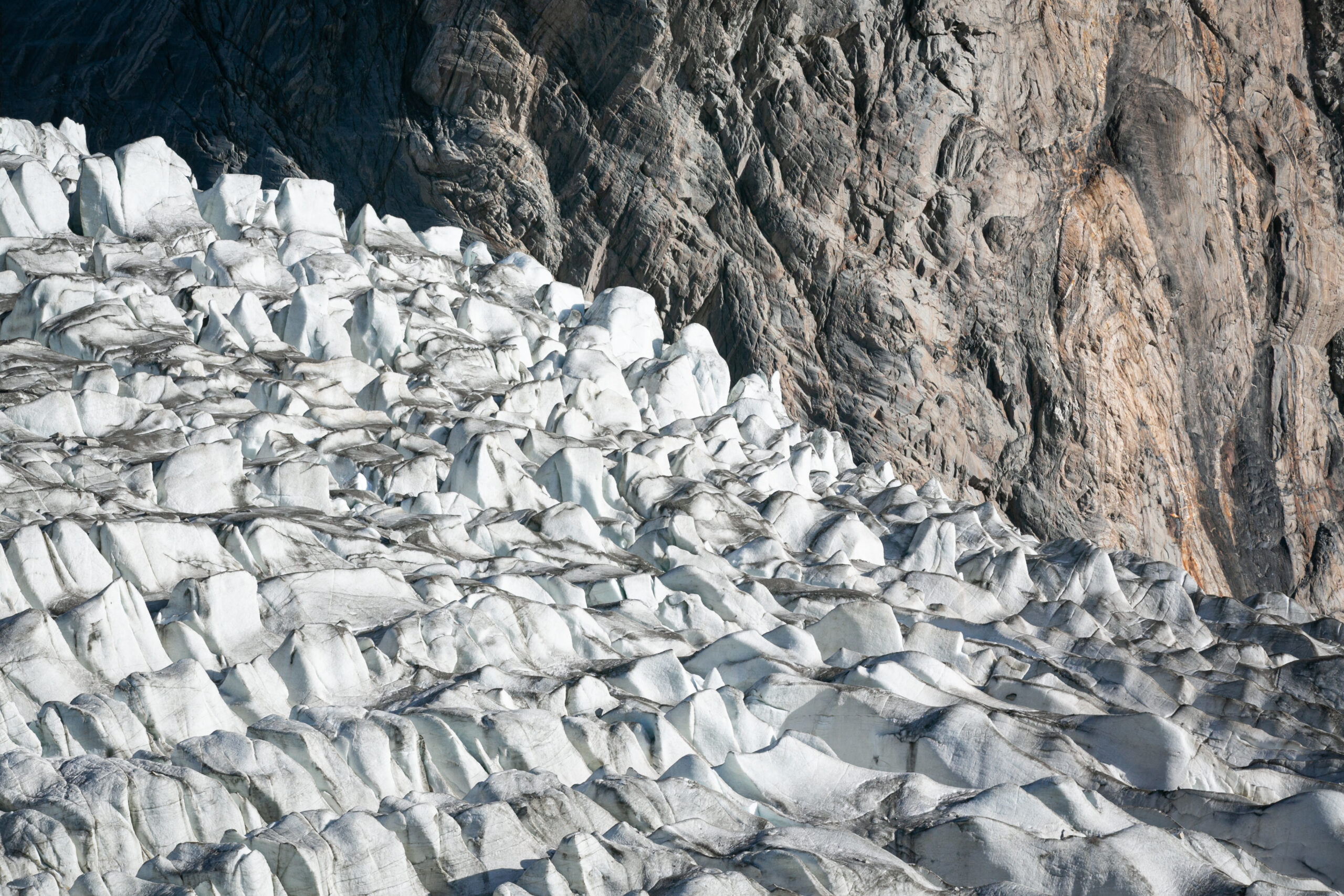
The glacier guide explains why seeing ice, walking beside it and crossing it require different preparation.
Shimshal, Deosai and alternative walks
Shimshal: choose the scale of the journey
- Route & access
- Passu → 4×4 transfer to Shimshal village → high-route camps → Shuijerab → Shimshal Pass → Shuwert pasture programme → return
- Time to allow
- Allow about 7–9 trekking days for a pass-and-pasture return, plus village access and rest days
- Elevation & distance
- Village around 3,100 m; Shimshal Pass approximately 4,735 m
- Usual season
- Usually June–September; current high-route conditions matter
- Difficulty
- Strenuous; exposed paths, consecutive camps and remote high terrain
The village, a guide-selected Yazghil viewpoint and the Shimshal Pass trek are distinct choices. The pass is around 4,735 metres, while Chafchingol and specialist glacier traverses need different planning and technical support. Minglik Sar is a mountaineering objective, not an ordinary trekking extension. Compare them in our detailed Shimshal guide.
Shimshal’s village approach and its high trekking routes are separate experiences. The road itself can be lengthy and rough, while remote camps need time, support and communication planning. Do not describe every Shimshal route as a quick hike from a hotel.
Deosai is high plateau terrain. A short permitted walk, a road-based excursion and a multi-day traverse differ. Seasonal access, conservation rules and exposure matter, even when the terrain looks open and gentle. Confirm whether the proposed visit actually includes hiking or mainly driving.
For travellers seeking gentler activity, locally guided village paths and selected lower viewpoints around Hunza or Baltistan may be a better fit than a high base camp. Ask for distance, surface and ascent; “easy” is not a sufficient description for a mixed-age group.
KP and Kashmir routes require a separate review of official advisories and permissions. Their inclusion in a hiking list does not establish that travel is currently appropriate.
Pakistan trekking routes
Major Karakoram glacier treks
These are expedition-length objectives. Arrange route-experienced leadership, full camp support and spare days before choosing flights. A glacier traverse needs a different equipment and rescue plan from a meadow walk.
K2 Base Camp and Gondogoro La
- Route & access
- Askole / Baltoro → Concordia → Ali Camp → Gondogoro La → Hushe
- Time to allow
- Allow roughly 14–18 trekking days, plus access, acclimatisation and contingency
- Elevation
- Pass approximately 5,585 m; the precise crossing line may be higher
- Usual season
- Usually a narrow summer window, commonly July–August; crossing depends on current snow and route-team assessment
- Difficulty
- Very strenuous; technical snow/ice crossing
This route adds a high pass and a Hushe exit to the Baltoro expedition. The ascent from Ali Camp and steep descent towards the Gondogoro Glacier are the decisive stages; they are not an interchangeable alternative to walking back along Baltoro. Expect a very early start and a long crossing day.
Planning details: Participants need fitness at altitude and instruction in the equipment specified by the technical leader. Confirm harness, helmet, crampon compatibility, rope arrangements and support staffing. Fixed ropes, when present, do not remove rockfall, avalanche or crevasse risk. A written itinerary must allow a retreat along Baltoro if the pass is unsafe; a crossing cannot be promised.
Route reference: GB Tourism: Gondogoro Pass.
Snow Lake and the Biafo–Hispar traverse
- Route & access
- Askole → Biafo Glacier → Snow Lake → Hispar La → Hispar village, Nagar
- Time to allow
- Allow about 14–18 trekking days; longer with exploration or difficult conditions
- Elevation
- Hispar La is commonly mapped at approximately 5,150 m
- Usual season
- High summer, generally July–August, after local snow assessment
- Difficulty
- Very strenuous; sustained glacier travel and roped snow terrain
Snow Lake is a broad glacial basin, not a liquid lake. The classic traverse links Baltistan and Nagar through two large glacier systems. It suits experienced trekkers seeking a continuous wilderness journey with repeated moraine stages, high camps and complex navigation. A return to Askole from Snow Lake is a different itinerary from crossing Hispar La.
Planning details: Snow-covered crevasses, softening snow, tributary-glacier crossings and poor visibility can slow progress substantially. Plan glacier travel with a team competent in rope systems and crevasse rescue, and carry enough food and fuel for delays. Camps, daily distances and the exit roadhead must be agreed for the current season. Historical fast crossings should never be used as a normal holiday timetable.
Route reference: American Alpine Journal: Hispar La context.
Pakistan trekking routes
Hushe, Nangma and Thalle: shorter Baltistan treks
Reach this part of Baltistan through Skardu and the Khaplu area. Shorter walking programmes still need a full transfer day, local support and realistic camp arrangements. Do not use the surrounding peaks’ summit heights as trekking elevations.
Masherbrum Base Camp
- Route & access
- Hushe → intermediate valley camps → Masherbrum-side base-camp area → Hushe
- Time to allow
- About 4–6 trekking days for a supported return programme
- Elevation
- Base-camp objectives commonly around 4,200 m; confirm the actual camp
- Usual season
- Generally June–September, with snow and access checks
- Difficulty
- Strenuous; rough moraine and substantial ascent
Masherbrum provides a focused Hushe-side mountain journey for travellers who cannot allocate the time required by Baltoro. The route moves from village and pasture landscapes into more broken mountain terrain. Its appeal is proximity to the mountain and time in Balti trekking country, rather than a collection of summit objectives.
Planning details: Ask which camp is meant by “base camp,” how much glacier terrain is involved and whether the programme includes a rest or weather day. A two-night rush may be unsuitable for an unacclimatised group. Bring footwear suited to loose ground and plan guide and porter support before leaving Hushe. Return by the agreed safe route; a summit climb is a separate expedition.
Route reference: GB Tourism: Hushe routes.
Charakusa Valley and the K6/K7 base-camp area
- Route & access
- Hushe → Charakusa approach → selected glacier-side camp → Hushe
- Time to allow
- About 5–7 trekking days for a return journey; extra for exploration
- Elevation
- Camp objectives often in the low-to-mid 4,000 m range; endpoint-specific
- Usual season
- Usually June–September; higher excursions require separate assessment
- Difficulty
- Strenuous; remote camps, moraine and route-specific glacier travel
Charakusa offers close views of dramatic granite walls and the K6/K7 mountain group. A trek to a lower valley camp, a glacier-side base-camp visit and a climbing expedition all have different demands. The itinerary should name the furthest planned camp and each optional excursion rather than treating the entire valley as one short hike.
Planning details: The exact line across or beside the glacier changes. Confirm guide experience, the gear needed for the selected route, communications and porter return arrangements. Allow time to enjoy the valley without depending on an ambitious final-day push. Do not accept an extension onto steep ice or a peak simply because it appears close to camp.
Route reference: GB Tourism: Charakusa and K6/K7.
Nangma Valley
- Route & access
- Kande village in the Hushe valley → Nangma meadows → selected upper camp → Kande
- Time to allow
- About 3–4 trekking days for a meadow-focused return; longer for upper camps
- Elevation
- Meadow and upper-camp programmes differ; climbing camps can reach about 4,300 m
- Usual season
- Generally June–September; confirm snow and stream conditions
- Difficulty
- Moderate to strenuous, depending on the selected camp
Nangma is a shorter introduction to Baltistan’s granite scenery. The valley is associated with serious rock climbing, but a walking visit can focus on meadows and camping below the walls. Access is from Kande, rather than automatically starting at Hushe village. Keep the walking programme distinct from climbs on the surrounding towers.
Planning details: Ask for the actual camp elevation and daily ascent: a low meadow outing and an upper climbing base camp are not equivalent. Arrange local porters or a supported camp, and confirm water treatment and sanitation. Rain can make trails slippery and increase streams. An overnight meadow stay gives more flexibility than combining the entire approach and descent with a long road transfer.
Route reference: American Alpine Journal: Nangma camp context.
Thalle La: Thalley–Shigar crossing
- Route & access
- Thalley valley → high pasture camps → Thalle La → Shigar-side exit, or reverse
- Time to allow
- About 4–6 trekking days, depending on roadheads and camp spacing
- Elevation
- Pass approximately 4,570 m
- Usual season
- Usually July–September, once the high pass is suitably clear
- Difficulty
- Strenuous high-pass trek; snow can change the difficulty
Thalle La links the Thalley/Khaplu side of Baltistan with the Shigar side. It offers pasture landscapes and a valley-to-valley journey without the long glacier commitment of Snow Lake. It still crosses a high pass, and should not be sold as an easy outing simply because it is often described as non-glaciated.
Planning details: Arrange transport at both ends and obtain a camp-by-camp plan before departure. Pass-day ascent, descent and snow conditions matter more than a headline kilometre total. A guide should choose the line after local assessment; early or late snow can require different equipment or cancellation. Keep extra time for access-track problems and avoid a fixed same-day flight connection after the trek.
Route reference: First-person hillwalking account: Thalle La.
Pakistan trekking routes
Astore, Rupal and Haramosh trekking routes
The Raikot/Fairy Meadows side is only one approach to Nanga Parbat. Astore’s Rupal side and the Haramosh valley offer different landscapes and logistics.
Rupal Valley and Nanga Parbat’s south-face camps
- Route & access
- Astore → Tarishing → Rupal valley → Herrligkoffer-side meadow camps; longer options towards Latobo
- Time to allow
- About 3–5 trekking days for a supported valley journey, depending on endpoint
- Elevation
- Many meadow/base-camp stages around 3,500–3,700 m; confirm each sleeping elevation
- Usual season
- Generally June–September, subject to the local approach
- Difficulty
- Moderate to strenuous; river, moraine and route-dependent glacier sections
The Rupal route approaches Nanga Parbat’s south face from Tarishing. It combines inhabited valley landscapes with high meadows below an immense mountain wall. A short visit to a first camp and a longer journey towards Latobo are separate programmes, and neither is the same itinerary as Fairy Meadows on the Raikot side.
Planning details: Ask whether glacier or river crossings are included, which camps will be used and how the route is affected by current water levels. Stage the journey to suit altitude adjustment rather than attempting all objectives in one day. Local guide and porter support are useful; accommodation beyond the villages is camp-based. Continuing over Mazeno Pass requires a separate technical plan.
Route reference: American Alpine Journal: Rupal valley camp context.
Mazeno Pass: Rupal–Diamer traverse
- Route & access
- Rupal valley → Mazeno approach and high camps → Mazeno Pass → Diamer-side descent
- Time to allow
- Often 10–14 or more trekking days for a substantial traverse; define the exact endpoint
- Elevation
- GB Tourism gives the pass at approximately 5,377 m
- Usual season
- High summer, subject to snow, technical assessment and permissions
- Difficulty
- Very strenuous; technical glacier and pass terrain
Mazeno, also written Mazino, is a specialist route around Nanga Parbat connecting the Rupal and Diamer sides. It belongs in a national trekking guide, but should be considered separately from a normal Rupal valley walk. It is also different from climbing the Mazeno Ridge.
Planning details: The team must assess snow and ice, rope requirements, high-camp spacing and evacuation options. Confirm which faces of the mountain and which roadheads the programme actually connects. “Around Nanga Parbat” can describe several different routes and does not establish a complete circuit. Build weather reserves into a supported expedition and agree an alternative if the pass cannot be crossed.
Route reference: GB Tourism: Mazino Pass.
Kutwal Lake and Haramosh Valley
- Route & access
- Gilgit–Skardu road / Sassi gateway → local upper roadhead → Iskere and Kutwal valley → lake
- Time to allow
- About 3–4 days for a comfortable supported walking visit; actual walking starts at the current roadhead
- Elevation
- A high meadow-and-lake objective; obtain measured camp elevations for the chosen route
- Usual season
- Generally June–September; earlier access depends on snow
- Difficulty
- Moderate to strenuous; steep approach, rough tracks and local crossings
Kutwal offers forest, village and meadow landscapes beneath the Haramosh mountain group. Vehicle access within the valley affects how much of the lower approach is walked. A route described as starting at Sassi can include a local jeep stage, so clarify the vehicle drop-off before comparing walking hours or distances.
Planning details: A supported camp gives time for the lake and surrounding meadows without compressing ascent and descent into one long day. Ask about footbridges, stream crossings, water treatment and porter arrangements. Facilities are limited beyond settlements. Avoid copying an all-purpose five-hour figure without knowing the starting point and return plan; the exact roadhead is a material part of the itinerary.
Route reference: GB Tourism: Kutwal and Haramosh.
Pakistan trekking routes
Chitral, Ghizer and the Hindu Kush
Check the approach as well as the trekking objective: current UK advice includes restrictions affecting the N45 approach to Chitral and travel close to the Afghanistan border. A destination’s name alone does not establish that the proposed access route is suitable.
These routes add a different mountain region to a Pakistan trekking holiday. Remote road access, river levels and permission checks can be as important as the walking itself.
Karambar Lake via Broghil
- Route & access
- Chitral → Mastuj → upper Yarkhun / Broghil → Lashkargaz → Karambar Lake
- Time to allow
- Allow about 3–5 trekking/camp days from the final usable vehicle access, plus substantial road and acclimatisation days
- Elevation
- Approximately 4,300 m; published official figures vary around 4,272–4,304 m
- Usual season
- Late June–early September, with a guide-confirmed access window
- Difficulty
- Strenuous high-altitude wilderness journey
Karambar, also written Karamber or Qurumbar, lies in the remote Ishkoman–Broghil landscape. A common access is from Upper Chitral through Lashkargaz, although the lake is associated administratively with Gilgit–Baltistan. The longer Ishkoman-side approaches and combinations with other passes are different itineraries.
Planning details: The final usable roadhead can change, so a “one-day trek” description does not capture the complete holiday. Arrange local guides, supplies and communications before entering the upper valley. Plan gradual sleeping-altitude gains, cold-weather camping and extra food. Check regional access and permissions for your nationality; do not assume a general Pakistan visa settles every route requirement.
Route reference: GB Tourism: Karambar access.
Tirich Mir Base Camp
- Route & access
- Chitral → Tirich valley / Shagrom → Sherniak → Shoghor Biasun → selected Babu Camp area
- Time to allow
- About 6–8 trekking days for a return programme; additional acclimatisation and access days
- Elevation
- Lower Babu Camp has been recorded at around 4,600 m; camp choice varies
- Usual season
- Generally July–August; wider summer dates depend on route assessment
- Difficulty
- Strenuous; moraine, glacier terrain and remote camps
This is a Hindu Kush base-camp journey, not an ascent of Tirich Mir. The route begins from the Shagrom area and progresses from valley terrain towards the Tirich glaciers. The name “base camp” is used for different sites, so require a named endpoint and sleeping-altitude profile. Some mountain faces remain hidden behind intervening ridges even from camp.
Planning details: Arrange route-experienced local leadership, porter support, glacier assessment and independent communications. The technical climbing routes and dangerous icefalls above the trekking approach are outside an ordinary base-camp visit. Allow enough time for acclimatisation and a safe return rather than using expedition descent times as a trekking schedule.
Route reference: American Alpine Journal: Shagrom-to-Babu Camp approach.
Naltar–Pakora / Ishkoman traverse
- Route & access
- Naltar valley → Shani-side camps → Pakora Pass → Pakora valley / Ishkoman
- Time to allow
- About 5–7 trekking days, with transport arranged at both ends
- Elevation
- A high pass roughly in the 4,600–4,700 m range; verify the selected crossing
- Usual season
- Usually July–September, after assessment of snow and streams
- Difficulty
- Strenuous; snow/glacier sections and a long descent
This traverse extends beyond the Naltar lakes into a valley-to-valley mountain journey. It can be useful for experienced walkers seeking a smaller expedition than Baltoro, with forests, pastures and high-pass terrain. Confirm that the proposal really crosses to Pakora: a Naltar lakes visit or a return from Shani is a shorter, different outing.
Planning details: Use a guide familiar with the pass and current glacier line. Agree camp spacing, crossing equipment, water sources and the descent route before departure. A published report of an exceptionally long descent is a reason to use sensible camps, not a target to repeat. Secure the Ishkoman-side pick-up and carry reserve supplies if the pass is delayed.
Route reference: First-person Naltar–Ishkoman trekking report.
Pakistan trekking routes
Kaghan and Siran Valley trekking options
Road access into upper Kaghan is seasonal. Summer lake visits still involve altitude, storm exposure and long return walks. Confirm the named trailhead rather than measuring the outing from Naran town.
Dudipatsar Lake
- Route & access
- Besal → Purbi valley / Mulla ki Basti → Dudipatsar Lake → return
- Time to allow
- Allow 2–3 trekking days for a supported return
- Elevation
- Lake approximately 3,800 m; published GPS/elevation figures differ
- Usual season
- Usually July–September once the trail and access road are open
- Difficulty
- Strenuous; long approach, streams and alpine exposure
Dudipatsar is a walking destination beyond the roadside lakes of upper Kaghan. The Besal approach travels through high pasture country towards an alpine basin. Published tracks put an approach in the region of 17–18 km one way; that is not a 17 km return day. Confirm the actual track and campsite with your guide.
Planning details: Camping partway makes the journey more realistic for many visitors than an endurance-style day trip. Ask about stream crossings, snow patches, food, water treatment and the return to Besal. Rain and cloud can make navigation harder; the route needs a turnaround plan. Do not combine a late descent with a long onward drive or assume seasonal stalls will provide all supplies.
Route reference: Recorded Dudipatsar trail context.
Ansoo Lake viewpoint
- Route & access
- Naran → Lake Saif-ul-Muluk trailhead → high ridge / Ansoo viewpoint → return
- Time to allow
- A full, demanding walking day; allow roughly 8–10 hours including breaks and a margin
- Elevation
- Viewpoint/ridge roughly 4,300 m; lake and viewpoint elevations differ
- Usual season
- Generally July–September, only with suitable snow and visibility
- Difficulty
- Strenuous; steep ascent, loose ground and seasonal snow
Ansoo is usually viewed from a high ridge above its bowl. This is considerably more demanding than a jeep visit to Saif-ul-Muluk. Published trail data includes an approximately 11 km point-to-point ascent route, so it should not be interpreted as an 11 km round trip. The exact starting point and chosen line matter.
Planning details: Stay near the trailhead beforehand, start early with a local guide and agree a turnaround time. Cloud may conceal the lake after a substantial climb. Snow and loose slopes can require a different technical assessment; do not descend into the lake basin simply to reach the shoreline. Horse availability on some lower stages does not remove the final walking demands.
Route reference: Recorded Ansoo route and viewpoint context.
Makra Peak
- Route & access
- Shogran → Paye meadows → Makra summit approach → return
- Time to allow
- One strenuous summit day from Paye; allow a separate arrival/acclimatisation night
- Elevation
- Summit approximately 3,885 m
- Usual season
- Summer into early autumn when snow and storms permit
- Difficulty
- Strenuous summit hike; steep final slopes
Makra offers a peak objective above the Shogran–Paye landscape. A meadow excursion and reaching the summit are distinct activities. The final ascent involves sustained climbing on mountain terrain and a substantial descent, so the itinerary should specify the summit turnaround time rather than treating Makra as an automatic add-on to Siri Paye.
Planning details: Use a local guide in unfamiliar conditions and check the ridge weather. Fog, lightning, wind and snow can end a summit attempt even while Shogran remains accessible. Roadhead differences explain inconsistent distance totals online; request the chosen route’s ascent and return distance. Carry sufficient water for the upper stages and preserve daylight for the descent.
Route reference: Recorded Makra route context.
Musa ka Musalla
- Route & access
- Manda Gucha / Siran valley approach, or a separately planned Paras–Sharan-side route
- Time to allow
- About 3–4 trekking days for a supported programme, depending on approach
- Elevation
- Approximately 4,000 m; precise published summit figures vary
- Usual season
- Generally June–September; snow routes are a separate undertaking
- Difficulty
- Strenuous; sustained climbing, long ridges and limited upper water
Musa ka Musalla gives a multi-day mountain objective in the Mansehra region. The Siran and Kaghan-side approaches have different transfers and camp plans. A recorded out-and-back track of around 35 km illustrates the commitment of one route, but should not be used as a universal distance for every approach.
Planning details: Confirm the last reliable water source and carry sufficient treated water for the summit stage. Camp placement, porter support and weather margins matter more than copying a fast twelve-hour track time. The upper ridge is exposed to sudden cloud and storms. Respect the shrine and local customs, and arrange a descent before dark rather than making the summit compulsory.
Route reference: Recorded Musa ka Musalla trail context.
Pakistan trekking routes
Swat and Upper Dir lake treks
Current advisory context: As checked on 5 October 2026, UK FCDO advice is against all travel to Swat and Upper Dir. These entries describe the routes for reference; international visitors should review their own government’s advice and insurance position before considering travel.
Swat and Upper Dir add forest and meadow routes to the national picture. Assess current regional travel advice and local access separately from the trail’s physical difficulty.
Jahaz Banda and Katora Lake
- Route & access
- Dir → Thal → current Takki Top roadhead → Jahaz Banda → Katora Lake → return
- Time to allow
- Allow 3 trekking days for a comfortable meadow-and-lake programme, plus road travel
- Elevation
- Katora Lake approximately 3,700 m
- Usual season
- Generally June–September; confirm snow and jeep-track condition
- Difficulty
- Moderate to the meadows; strenuous for the lake stage
Jahaz Banda and Katora belong to the trekking branch from Thal, rather than the same outing as the Kumrat forest valley. The walk from the usual jeep drop-off to the meadows commonly needs 2–4 hours one way. Katora adds a rocky ascent; allow roughly 3–5 hours each way from Jahaz Banda, depending on the selected line and conditions.
Planning details: Stay near Jahaz Banda before the lake day, then return or descend on a separate stage. Confirm basic hut or tent arrangements, water treatment and local guide support. A traveller happy with the meadow walk may reasonably omit the lake. Do not combine the upper lake with both the initial ascent and final jeep transfer unless the team is specifically prepared for a very long day.
Route reference: Jahaz Banda and Katora route context.
Kundol Lake from the Utror side
- Route & access
- Kalam → Utror → Ladu / current local roadhead → Kundol Lake → return
- Time to allow
- Allow a full walking day; around 5–8 hours return from a suitably close roadhead
- Elevation
- Lake approximately 3,030 m
- Usual season
- Usually summer, particularly July–September, subject to access
- Difficulty
- Moderate to strenuous; uneven trail and access-dependent length
Kundol, also written Kundal, is reached through the Utror side of upper Swat. Jeep access and the usable roadhead have changed over time, so ask precisely where walking starts. A short trek from an advanced roadhead and walking the whole lower approach are not the same day.
Planning details: Use a local guide for current trail and crossing conditions. Confirm the return vehicle and whether rain has damaged the approach. Carry water, food, layers and a headtorch even if the outing is described as a day hike. Basic seasonal services are not a substitute for a complete walking plan. More remote lake traverses need their own camps and route assessment.
Route reference: PTDC: Utror and Kundol context.
Pakistan trekking routes
Kashmir: alpine lakes and longer crossings
Current advisory context: As checked on 5 October 2026, UK FCDO advice is against all but essential travel to Azad Jammu and Kashmir and against all travel within 10 miles of the Line of Control. Check the exact route, your nationality’s access requirements and insurance before making plans.
Neelum and Shounter routes need access and permission checks for the exact traveller and locality. Border-related restrictions, road conditions and weather can affect an otherwise feasible walking itinerary.
Ratti Gali Lake
- Route & access
- Neelum valley → Dowarian → jeep-accessible base-camp area → Ratti Gali Lake → return
- Time to allow
- One outing from the upper base-camp area, with 1–2 nights locally as appropriate; road travel additional
- Elevation
- Lake approximately 3,700 m
- Usual season
- Usually the settled high-summer period, commonly July–September
- Difficulty
- Moderate at a close roadhead; harder if walking more of the approach
Ratti Gali is an alpine lake outing whose walking length depends heavily on how far the jeep track is usable. The rough approach from Dowarian is commonly described as around 18 km; this is vehicle/access distance, not automatically the length of the final lake hike. Official and local walking-time descriptions vary with their assumed starting points.
Planning details: Confirm the current jeep endpoint, actual return walking time and camp facilities before booking. Staying locally avoids forcing access, lake visit and a long Neelum transfer into one day. Do not confuse the lake visit with the longer Ratti Gali–Saral–Kaghan crossing. Read our Kashmir lakes guide for further regional context.
Route reference: National Tourism Portal: Ratti Gali.
Chitta Katha Lake
- Route & access
- Kel → Shounter / Domail–Hoz-side roadhead → Dak camps → Chitta Katha → return
- Time to allow
- Allow about 2–3 trekking days, plus the Neelum and jeep approach
- Elevation
- Lake approximately 4,100 m
- Usual season
- Usually July–September, with current snow and road checks
- Difficulty
- Strenuous; large ascent, rocky trail and altitude
Chitta Katha is a higher and more demanding lake trek in the Shounter landscape. The walk is commonly staged through lower Dak camping areas, followed by the lake outing and return. A published GPS approach is about 9.5 km one way with roughly 1,300 m of cumulative ascent; it does not describe a gentle 9.5 km return walk.
Planning details: Choose camps with your guide rather than assuming a lakeside night is necessary. Lower camps can offer a more manageable sleeping altitude and shelter. Rain makes steep, rocky sections harder, and late snow may alter the route. Confirm the final roadhead, porters, water treatment, communications and permission requirements before leaving Kel.
Route reference: Recorded Chitta Katha approach.
Pakistan trekking routes
Shorter hikes: Hunza, Galiyat and Islamabad
A national trekking guide should also help travellers choose a realistic first walking objective. Lower commitment does not mean every route is suitable in all weather.
Ondra Poygah and Ultar Meadows
- Route & access
- Ondra: Gulmit stair route; Ultar: Karimabad gorge approach
- Time to allow
- Ondra about 2–3 hours return; Ultar about 7–9 hours return or an overnight programme
- Elevation
- Ondra viewpoint roughly 2,700–2,800 m; Ultar meadow roughly 3,270–3,300 m
- Usual season
- Snow-free conditions; Ultar needs a guide-confirmed seasonal route
- Difficulty
- Ondra: sustained stairs; Ultar: strenuous gorge and uneven terrain
These are two useful Hunza options with very different demands. Ondra Poygah is a short viewpoint climb involving many steps. Ultar is a substantially longer mountain walk with route-finding and exposed sections depending on the current trail. A day in Karimabad does not automatically leave enough time for a complete Ultar return.
Planning details: Choose according to ascent tolerance and the day available. Allow breaks and take care descending steps on Ondra; use local route advice for Ultar and consider camping if the full day is too demanding. Our Hunza and Nagar trekking guide gives the more detailed route comparisons, including Rakaposhi, Rush Lake and Patundas.
Masur Rock, Skardu
Masur Rock is a separate viewpoint hike above the Skardu valley. It can be considered as a locally guided walking day within a Baltistan stay, rather than as part of the K2 Base Camp route. Ask your guide to confirm the current trailhead, return walking time, ascent and conditions before choosing it.
Miranjani and Mushkpuri, Galiyat
- Route & access
- Miranjani from the Nathia Gali side; Mushkpuri from Dunga Gali or Nathia Gali
- Time to allow
- Mushkpuri roughly 2–4 hours return; Miranjani roughly 4–6 hours return, allowing breaks
- Elevation
- Miranjani approximately 2,950 m; Mushkpuri approximately 2,800 m
- Usual season
- Commonly spring–autumn in suitable conditions; winter snow changes the activity
- Difficulty
- Mushkpuri: moderate forest climb; Miranjani: longer sustained ascent
These forest-and-ridge hikes offer an accessible alternative when a remote expedition is unsuitable. Mushkpuri is generally the shorter introduction, while Miranjani asks for more sustained uphill walking. A recorded Miranjani approach of approximately 5 km is a point-to-point track; leave time for the descent rather than treating it as the complete return outing.
Planning details: Carry drinking water, waterproof layers and offline navigation. Mist, rain and slippery ground can affect an established path, while winter ice requires different equipment and judgement. Base yourself in Galiyat to avoid combining a late descent with unnecessary road travel. Longer forest routes towards Dagri or Thandiani need a separate full route and water plan.
Route reference: Recorded Miranjani route.
Margalla Hills day hikes, Islamabad
- Route & access
- Established trails such as Trail 3 and Trail 5; choose a named endpoint and return route
- Time to allow
- Allow about 2–4 hours for a selected half-day outing; longer loops vary
- Elevation
- Lower hill terrain; maximum height depends on the chosen endpoint
- Usual season
- Cooler months and early starts; check current park access and weather
- Difficulty
- Moderate on the main climbs; steep sections require fitness
Margalla is useful for a first walk, a fitness check or a flexible day before a northern journey. Trail names cover routes of different lengths, and a short lower-path walk is not equivalent to climbing all the way to a ridge. Choose an endpoint that fits the heat, daylight and the group’s experience.
Planning details: Carry sufficient water and use established open paths. Hot weather, thunderstorms and wet rock can be more relevant than altitude here. Confirm current closures and park guidance, and avoid unfamiliar shortcuts. This is a preparation outing, not a substitute for acclimatisation before sleeping at high camps in the Karakoram.
Fitness, altitude, season and permissions
Build fitness for consecutive walking days, uneven ground and sustained descents. Clarify whether you carry a daypack or a heavier load. Walking hours should include a realistic pace and breaks, with flexibility for the slowest member of the group.
The highest point and sleeping elevations are different measurements. Build gradual altitude adjustment into the camp plan and discuss personal concerns with a travel-health professional. CDC’s altitude guidance is a useful reference, not a replacement for an individual assessment.
Read our seasonal hiking guide for the month comparison. Check road access, snow, water crossings and current weather. Confirm trekking permissions through the official visa and permission process and the responsible authorities for the exact objective.
Insurance must match the activity, region and maximum altitude. Ask about rescue arrangements without assuming immediate helicopter availability. A written proposal should make guide roles, porter support, equipment, accommodation and meals clear. For Crossroads trekking programmes, meals are included on the trekking days as specified in the proposal; other travel-day inclusions must be stated separately.
Choose a trekking style that fits your holiday
If you have only one or two walking days
Choose a guesthouse-based village or viewpoint outing and allow enough time to reach it. Gulmit’s Ondra Poygah stairs, a locally selected Hunza village circuit or a shorter meadow walk may be more appropriate than a remote camp objective. A full Ultar outing is considerably more demanding than a gentle village walk, even though both can start near Karimabad.
If you want your first supported camping trek
Discuss a route with manageable daily ascent, dependable camp arrangements and clear retreat options. Rakaposhi may suit a fit walker who understands its sustained climb; it is not automatically an easy option. Ask your team to match the plan to your recent walking history, previous altitude exposure and confidence on rough ground.
If your goal is glacier scenery
Seeing a glacier from a selected viewpoint, walking beside a glacier and crossing it are different activities. A viewpoint can be rewarding without entering ice. If the itinerary involves a crossing, discuss the guide’s recent route knowledge, required equipment and rescue capability before deciding.
If your goal is a remote expedition
K2 Base Camp, Shimshal’s high routes and other expedition objectives need a larger time commitment and tolerance for changed plans. Evaluate consecutive-day endurance, camp living, exposure and emergency arrangements. A fixed departure is still subject to conditions; the dates do not guarantee that a particular crossing or objective can be completed.
Walking days, travel days and spare days
A trek advertised as three days may need a much longer Pakistan itinerary. Keep five separate components in the plan:
- Arrival and regional travel: international arrival, domestic flights or long road transfers.
- Acclimatisation: suitable staging and rest before committing to high camps.
- Trail access: local jeep travel and any walking approach to the first overnight location.
- The trek itself: walking, rest or acclimatisation days and the planned return.
- Contingency: road, flight and weather delays before your onward commitments.
Confirm whether the advertised duration counts all of these. A 12-day supported journey and a five-day walking route can describe the same holiday at different levels. Neither should be presented as the other without explanation.
For each walking day, ask for distance, likely hours, ascent, descent and sleeping altitude. Check whether a distance is one-way or return, and whether it includes a base-camp side walk. A glacier’s length is not the trek distance. Different trailheads and changed river or glacier crossings also affect totals.
Weather, temperatures and equipment
Use a forecast for the actual route and elevations. A sunny afternoon in Hunza or Skardu does not describe an exposed camp above 4,000 metres. For high camping, prepare for nights below freezing during the trekking season and for colder conditions during a storm. These are planning scenarios, not measured monthly averages for every trail.
Choose a sleeping bag by its comfort rating, paired with an insulated mat. Discuss the appropriate rating with your guide; a warm-looking bag labelled with an “extreme” survival temperature may still leave you cold. A climbing objective or very exposed camp needs its own equipment specification.
| Day walks | Supported camping | Technical glacier or climbing routes |
|---|---|---|
| Footwear with grip, layers, sun protection, water, food and a headtorch | All day-walk essentials plus a suitable sleeping bag, insulated mat, dry camp clothing and spare power | A route-specific list from the responsible technical guide, with compatible equipment and training |
| A chosen route and turnaround time, offline navigation and relevant identification | Confirmed tents, meals, fuel, water treatment, sanitation, communications and reserve supplies | Skilled leadership, appropriate snow/ice or rope systems and rescue capability as required |
Break in footwear before departure and protect dry clothing in waterproof bags. Tell your team about medication, allergies and dietary needs before the shopping and load planning are completed. Technical gear should be fitted and practised with; carrying a harness or crampons does not establish competence.
Use our best time for hiking in Pakistan guide to compare seasons, then check Pakistan Meteorological Department warnings and current local reports before travelling.
Guides, camps, costs and responsible trekking
Ask for a quote tied to the precise route and number of days. Group size, porter support, road access, equipment and camp standards affect the price. There is no dependable universal per-person cost for trekking in Pakistan.
- Team: guide experience on the route, cook and porter arrangements, load limits and the plan if someone needs to return early.
- Camp: sleeping and dining tents, mats, toilets, waste management, water treatment and charging arrangements.
- Food: meals included on the trekking days, with travel-day meals and dietary arrangements stated separately.
- Access: flights or ground transport, local jeeps, permits and any applicable fees.
- Emergencies: first aid, communications, insurance requirements and who coordinates or pays for evacuation.
- Changes: extra days, illness, bad weather, road closure and cancellation terms.
Premium support in a remote camp is about preparation, suitable equipment, capable people and attention to practical details. It should not imply hotel facilities or guaranteed connectivity where they do not exist.
Confirm permissions for your nationality, route and activity with the responsible authorities. International visitors can begin with our Pakistan visa guide for international travellers, while recognising that entry permission and mountain-route permission are separate matters.
Use agreed paths and camps, respect grazing land and community privacy, keep sanitation away from water sources, and carry waste out. Pay fairly for local expertise and ask before photographing people. A quieter route still belongs to the communities and ecosystems that sustain it.
Frequently asked questions
Which major treks should a first Pakistan visit consider?
For a shorter supported mountain journey, compare Rakaposhi, Nangma and the Rupal valley according to your experience. For a longer wilderness objective, compare K2 Base Camp, Batura, Shimshal Pass or Karambar with a detailed camp plan. Gondogoro La, Snow Lake and Mazeno require additional technical assessment; popularity is not a suitability rating.
Is Snow Lake a shorter alternative to K2 Base Camp?
Not necessarily. The Biafo–Hispar traverse is a substantial glacier expedition with high camps, roped snow travel and complex navigation. Compare total travel days, support and terrain rather than assuming the less familiar name means an easier trek.
Do the same summer months suit every route?
No. A lower forest hike may work when a high pass is snowbound. Monsoon rain, meltwater, snow stability, road damage and regional restrictions affect routes differently. Confirm the conditions for the exact objective before travel.
Which Pakistan trek is best for beginners?
Choose the actual terrain and itinerary rather than a popular name. Selected village and viewpoint walks can be a better start than remote or glacier routes. A first camping trek still needs suitable fitness, acclimatisation, support and retreat options.
How many days do Rush Lake and Shimshal Pass need?
Allow roughly 5–7 or more trekking days for Rush Lake and 7–9 for a Shimshal Pass and pasture journey, with a gradual ascent plan. Add regional travel, preparation and contingency; exact routes can take longer.
Are meals included on a Crossroads trekking journey?
Meals are included on the trekking days as specified in your proposal. Meals on other travel days must be stated separately; check the written inclusions before booking.
Is K2 Base Camp a climb to K2’s summit?
No. A base-camp trek and a summit expedition are completely different objectives and require different skills and support.
Can I choose a trail by its maximum height alone?
No. Surface, daily ascent, river or glacier crossings, sleeping elevations and remoteness matter too.
Are glacier routes suitable for independent beginners?
They require competent local assessment and appropriate skills, equipment and support. Choose a gentler non-glacier walk if those requirements are not met.
What should a detailed trekking itinerary include?
Daily route, walking hours and distance, ascent, camp elevation, rest days, support, permits, equipment, meals and contingency arrangements.
People · Places · Purpose
Plan a journey around your interests
Tell us your dates, starting point and preferred pace. We will discuss a private route with realistic travel days and appropriate local support.
Discuss your private journey →Sources and updates
Route-specific references appear beneath the new regional entries. They include official tourism pages, recorded trail data, first-person trekking reports and the American Alpine Journal. Historical expedition accounts establish route context, not current access, permit rules or safe crossing conditions. Planning-day ranges and proposed pacing are editorial guidance; obtain a current local camp plan. Where official or GPS elevations differ, figures are rounded or the difference is stated.
Additional practical references: official Fairy Meadows and Raikot-side base-camp context; PakTrails Rakaposhi route data; our Hunza and Nagar route guide; and our Shimshal trekking guide. Approximate ranges reflect differing camps and endpoints; reconfirm your own mapped itinerary.
Geographical and historical references are linked below. Suggested pacing and travel allowances are Crossroads planning guidance. Reconfirm road access, permissions, opening times and prices before travel.