Crossroads field guides · Karakoram · Mountain environments
Pakistan’s glaciers are part of a living mountain environment: they shape rivers, routes and the daily lives of valley communities. A roadside ice view, a guided glacier walk and a multi-day expedition are different activities. This guide explains the principal landscapes and how to choose an appropriate level of involvement.
By Sultan Uddin · Crossroads Adventure · Editorial review: 4 October 2026
How to understand glacier statistics
Glacier inventories change as mapping methods and definitions improve. UNDP’s 2024 material referred to 13,032 glaciers across Pakistan’s northern ranges. Older articles often repeat a smaller total without identifying the inventory year. A number is useful only when its source and date are clear; it is not a measure of how many glaciers are open to visitors.
Ice length and area also vary with the definition of the glacier system, survey date and seasonal conditions. Avoid choosing an expedition because one glacier is advertised as a fixed global rank. Route suitability, support and your experience matter more than superlatives.
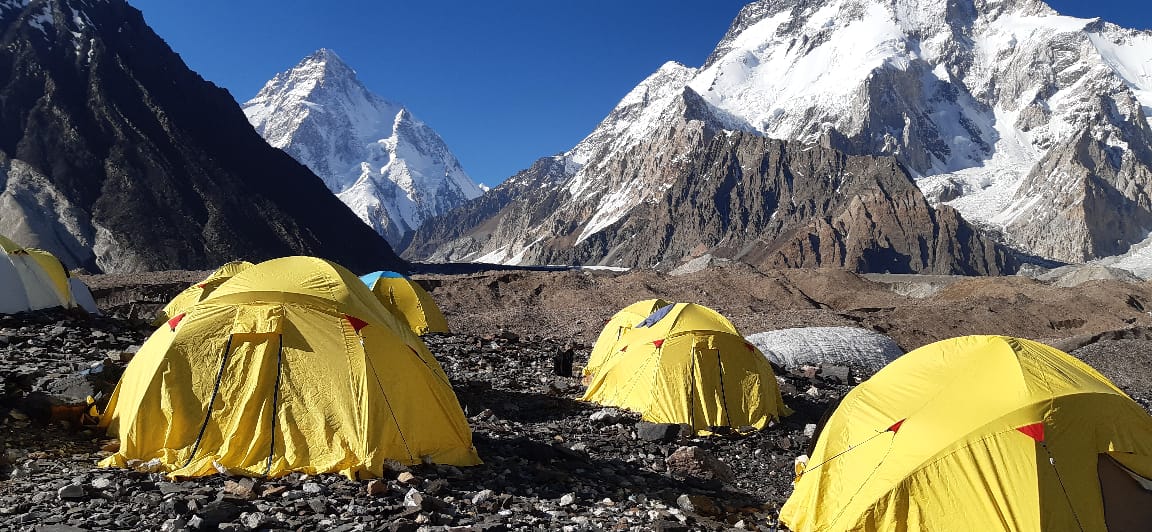
Baltoro and the Concordia approach
Baltoro belongs to the great Karakoram trekking landscape accessed through Baltistan. Skardu is the logistical base, with the approach through Shigar and the Braldo corridor before the wilderness section. Concordia and the K2 Base Camp area require a substantial expedition plan; they are not short excursions from a Skardu hotel.
A long route means repeated days over moraine and uneven ground, high camps and limited services. Ask for the exact camp sequence, rest days, support team and return plan. Check whether the proposal returns along Baltoro or includes a technical pass crossing; those options are not equivalent.
The GB Tourism K2 entry describes a general 14–20-day trek range and June–September season. Your total trip should also allow transport and contingency days. Do not compress acclimatisation to match a flight booking.
Biafo–Hispar and Batura
Biafo–Hispar: an expedition, not an easy ice highway
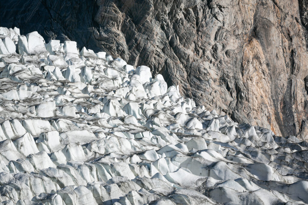
The Biafo, Snow Lake and Hispar landscape is remote and route-finding can be complex. Snow cover may conceal crevasses. A traverse requires an appropriately skilled team, suitable equipment and an evacuation plan. The appealing phrase “glacial highway” should never imply an ordinary walking trail.
Batura: Upper Hunza’s longer valley journey
Batura can be explored through a carefully planned trekking programme from Upper Hunza. The valley includes ice, moraine and grazing areas; the chosen route determines how much glacier travel is required. Ask about camp locations, porter arrangements and the condition of river crossings.
Passu and Ghulkin: views are not crossings
Around Passu and Ghulkin, glacier scenery sits close to inhabited villages and the road corridor. That proximity can make photography easier, but it does not make the ice inherently safe. A designated viewpoint, a walk beside moraine and a crossing onto ice each require a different assessment.
| Activity | Typical planning approach | Important distinction |
|---|---|---|
| Roadside or designated viewpoint | Short visit with safe vehicle parking | A view does not establish permission to enter the ice |
| Guided glacier-edge walk | Half-day or full-day route agreed locally | Distance and equipment depend on the selected path |
| Glacier crossing or high ridge approach | Specialist route assessment and equipment | Ordinary sightseeing footwear may be inadequate |
| Remote multi-day traverse | Expedition team, camps, permits and rescue planning | Limited communications and lengthy evacuation |

Climate, hazards and responsible travel
Glacier change is not uniform across every valley. The “Karakoram anomaly” describes patterns studied in parts of this mountain region; it does not mean all Pakistan glaciers are stable or that climate risk is absent. Meltwater, unstable debris and glacial lake outburst floods can affect settlements and roads well below the ice.
UNDP’s glacial risk work connects monitoring with community resilience. For travel, the practical response is to check local warnings and respect closures. Do not approach a glacier snout, enter ice caves or cross a meltwater stream for a photograph without competent assessment.
Mountain temperatures depend on elevation, wind, cloud and time of day. Carry layered clothing and check current forecasts alongside your guide’s observations. A sunny valley forecast is not a high-camp forecast.
For route selection, compare our hiking routes guide and seasonal hiking guide. The river guide explains the downstream connection. Our trekking gallery provides visual context without replacing terrain assessment.
Travel with appropriate local guides, minimise campsite impact, carry out waste and respect pasture use. Confirm trekking permissions and insurance for the maximum elevation and activity. Rescue availability should be discussed honestly; it cannot be treated as an automatic helicopter service.
Frequently asked questions
How many glaciers does Pakistan have?
Inventory totals vary. UNDP’s 2024 material refers to 13,032; cite the inventory and year rather than presenting any total as permanently fixed.
Can I see glaciers without a long trek?
Some Upper Hunza locations offer views from roads or short approved walks. Entering or crossing ice is a separate activity.
Is Baltoro a day trip from Skardu?
No. The Concordia and K2 Base Camp route requires a multi-day expedition and substantial logistical preparation.
Do all glaciers require crampons?
Equipment depends on the exact route and conditions. Ask the guide to specify requirements rather than assuming one rule applies to every glacier view or walk.
People · Places · Purpose
Plan a journey around your interests
Tell us your dates, starting point and preferred pace. We will discuss a private route with realistic travel days and appropriate local support.
Discuss your private journey →Sources and updates
Geographical and historical references are linked below. Suggested pacing and travel allowances are Crossroads planning guidance. Reconfirm road access, permissions, opening times and prices before travel.