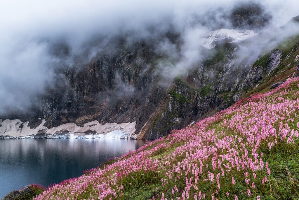
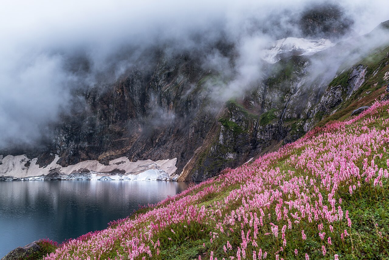
Cover photograph: Ratti Gali Lake surrounded by alpine mountains and flowers in Azad Kashmir. Maqsood aktar / Wikimedia Commons · CC BY-SA 4.0. Resized for display; the cover may be cropped.
Crossroads field guides · Pakistan-administered Kashmir · Lake landscapes
The lakes of Azad Jammu and Kashmir range from a road-accessed artificial lake near Rawalakot to demanding alpine destinations above the Neelum Valley. They should not be grouped as equally easy family outings. This guide compares the main places, their approximate elevations and the access checks that come before a journey.
By Sultan Uddin · Crossroads Adventure · Editorial review: 4 October 2026
Know the region before planning
This guide concerns lakes in Pakistan-administered Kashmir, commonly called Azad Jammu and Kashmir. It does not cover every lake across the wider Kashmir region. The Rawalakot–Banjosa area and the upper Neelum–Shounter area require different routes and overnight bases.
At this review, UK official advice advises against all but essential travel to Azad Jammu and Kashmir and against all travel close to the Line of Control. Current local disruption can also affect movement. International visitors should check their own government advice, insurance and permissions before committing to a lake itinerary. Read the official regional guidance.
Compare the main lakes
| Lake | Setting | Visitor planning |
|---|---|---|
| Ratti Gali | Neelum Valley; around 3,700 m | Seasonal jeep approach and walking route; allow altitude adjustment |
| Chitta Katha | Shounter Valley; around 4,100 m | Demanding mountain walking and overnight logistics |
| Saral | High country near the Neelum–Kaghan watershed | Remote trekking rather than a routine roadside visit |
| Shounter | Upper Shounter Valley | Seasonal track access; confirm the specific destination |
| Banjosa | Near Rawalakot; around 1,981 m | Artificial lake with a lower-effort visit when access is permitted |
Elevations are rounded where sources differ; they are not GPS readings for every campsite. Published distances that end at a village, jeep terminal or base camp should not be treated as distances all the way to an alpine shore. Ask where the vehicle stops and how much walking remains.
Ratti Gali: approach from Dowarian
Ratti Gali is reached through the Dowarian side of the Neelum Valley. The seasonal approach is commonly planned with local jeep transport towards the base-camp area, followed by a walk to the lake. Track condition, snow, queues and your walking pace can change the day substantially.
Reserve enough time to return in daylight. Ask for the current vehicle endpoint, walking time and fallback plan before starting. Do not convert a map’s straight-line distance into a road estimate or assume horses remove the need for fitness and altitude planning.
The National Tourism Portal reference gives a rounded elevation near 3,700 m. The lake is not a low-level walk simply because jeeps may reach a nearby camp.
Chitta Katha, Saral and Shounter
Chitta Katha
Treat Chitta Katha as a high mountain objective. A published approximate elevation of 4,100 m helps explain why a quick ascent from the valley deserves caution. Discuss the overnight schedule, route condition, support and a turn-around plan with a locally experienced guide.
Saral and other remote lakes
Saral and the neighbouring high-country routes require careful navigation and current trail knowledge. A list of nearby lakes is not proof that all can be linked in one easy day. Use a route-specific itinerary with camps, water and support clearly identified.
Shounter
The valley landscape and the lake are separate subjects for captions and planning. Confirm that a photograph actually shows the named lake before using it as an identification guide. Seasonal track access can end before the intended walking start.
Banjosa: a different kind of lake visit
Banjosa is an artificial lake near Rawalakot, not a glacial lake high in the Neelum mountains. Salam Pakistan gives an elevation of 1,981 m. That difference makes it useful for comparing landscape types and walking demands, but it does not override the region’s current access situation.
The Bank of AJK describes it as around 20 km from Rawalakot. Plan the actual approach, parking and walking arrangements with your driver. Facilities, boating and opening arrangements should be confirmed for the day; do not assume every listed activity is operating.
Season, temperature and preparation
The alpine lake season depends on snow clearance and the state of local tracks, usually within the warmer part of the year. A June–September label is a broad planning window, not proof of access on a particular June or September date. High routes can remain snowbound after lower villages warm up.
At alpine elevations, cold nights, wind and sudden weather changes are possible even in summer. Carry warm and waterproof layers. Check current weather information and ask for observations from the intended route. We do not supply a single summer temperature as a guarantee for every lake.
Allow time for altitude adjustment, choose an appropriate pace and discuss medical concerns with a travel-health professional. CDC’s altitude guidance provides background. Agree accommodation, toilets, water, communications and evacuation arrangements before a remote walk.
Carry out litter, keep camp away from sensitive shorelines and do not enter cold unfamiliar water. For comparison with northern routes outside Kashmir, use our hiking routes guide, seasonal guide and destination planning guide.
Frequently asked questions
Are all Kashmir lakes suitable for non-trekkers?
No. Banjosa and high alpine objectives such as Chitta Katha have very different terrain and logistical requirements.
Can I drive all the way to Ratti Gali Lake?
Vehicle access typically ends at an approach area rather than replacing the whole walk. Confirm the current endpoint and remaining trail.
Is Banjosa a natural glacial lake?
No. It is an artificial lake near Rawalakot.
Does a summer itinerary mean access is confirmed?
No. Snow, road condition, local permissions and official travel guidance must be checked for the intended dates.
People · Places · Purpose
Plan a journey around your interests
Tell us your dates, starting point and preferred pace. We will discuss a private route with realistic travel days and appropriate local support.
Discuss your private journey →Sources and updates
Geographical and historical references are linked below. Suggested pacing and travel allowances are Crossroads planning guidance. Reconfirm road access, permissions, opening times and prices before travel.