Crossroads field guides · Desert landscapes · Heritage
Pakistan’s desert landscapes range from inhabited dunes in Sindh and Punjab to high mountain sand near Skardu. They differ in climate, culture and accessibility. This guide helps you choose the right region, understand what you are seeing and plan a journey with realistic transport and local support.
By Sultan Uddin · Crossroads Adventure · Editorial review: 4 October 2026
Five landscapes, different journeys
| Landscape | Region and useful base | Main reason to visit |
|---|---|---|
| Thar | Sindh; Mithi and Nagarparkar | Village culture, temples and Karunjhar scenery |
| Cholistan | Southern Punjab; Bahawalpur | Derawar Fort and desert heritage |
| Thal | Punjab; Bhakkar and nearby districts | Sand, farming and local settlement patterns |
| Kharan | Balochistan | Remote arid landscape; significant access constraints |
| Katpana and Sarfaranga | Skardu and Shigar, Gilgit-Baltistan | Dunes beneath high mountain scenery |
“Cold desert” refers to an arid high-elevation setting, not a promise that every summer afternoon is cold. Katpana and Sarfaranga are distinct dune areas and should not be used as interchangeable place names. None of these landscapes is empty land: people, livestock, agriculture and heritage sites need respectful access.

Thar: settlements, temples and seasonal colour
Thar is a cultural landscape as much as a dune landscape. Mithi offers an introduction to the towns and communities of the region. Around Nagarparkar, the Karunjhar hills and historic Jain temple sites add a different visual and historical setting. Choose a local guide who can explain the context and ask permission before entering private places.
A visitor itinerary should leave time for village conversations, craft purchases and travel between dispersed places. Avoid staging portraits or assuming that every community wants photography. Rain may change the desert’s appearance, but a green season does not guarantee comfortable road conditions.
Cholistan: Derawar and Bahawalpur
Bahawalpur is a practical base for Cholistan’s heritage. Derawar Fort rises from a broad desert plain, while the city provides context through its palaces and former princely-state history. Confirm access separately for each property; being able to see a fort exterior does not guarantee admission inside.
For private planning, allow roughly 95–110 km and about two to three hours each way between Bahawalpur and the Derawar area, depending on the start and road conditions. This is a broad Crossroads allowance, excluding visits and meals. A full-day excursion gives a more comfortable pace than squeezing it into a long intercity transfer.
The Cholistan rally is a dated event with crowd, access and accommodation implications. Confirm the year’s official programme before building a journey around it. A quiet heritage visit and a rally visit deliver very different experiences.
Thal, Kharan and the northern dunes
Thal: look beyond an untouched-desert stereotype
Thal’s sandy landscape sits alongside settlements, canals and cultivated land. It is useful for understanding how water and farming change an arid region. Do not assume a public viewpoint permits entry to private fields or grazing areas.
Kharan: geographical interest is not a travel recommendation
Kharan lies in Balochistan. Remoteness, services, permissions and the security situation make it very different from a Bahawalpur excursion. Official advisories currently advise against travel to Balochistan. We do not present it as a routine independent sightseeing addition.
Katpana and Sarfaranga: sand in the mountains
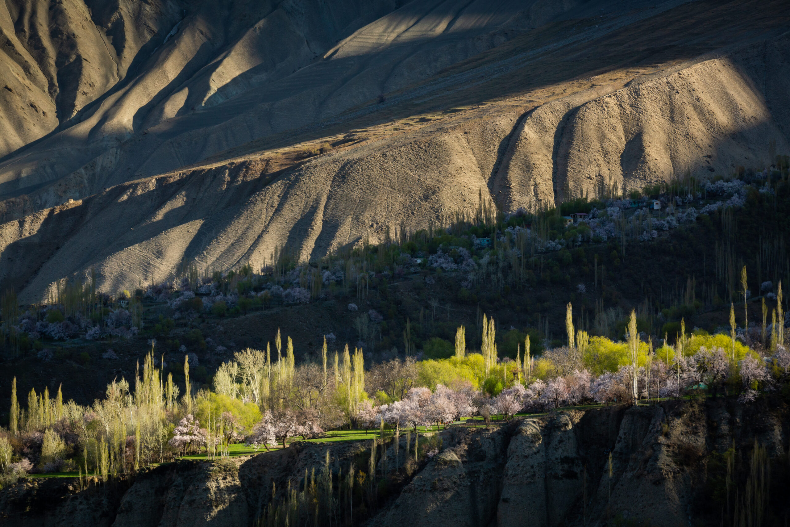
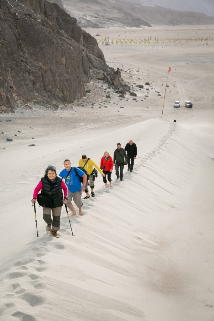
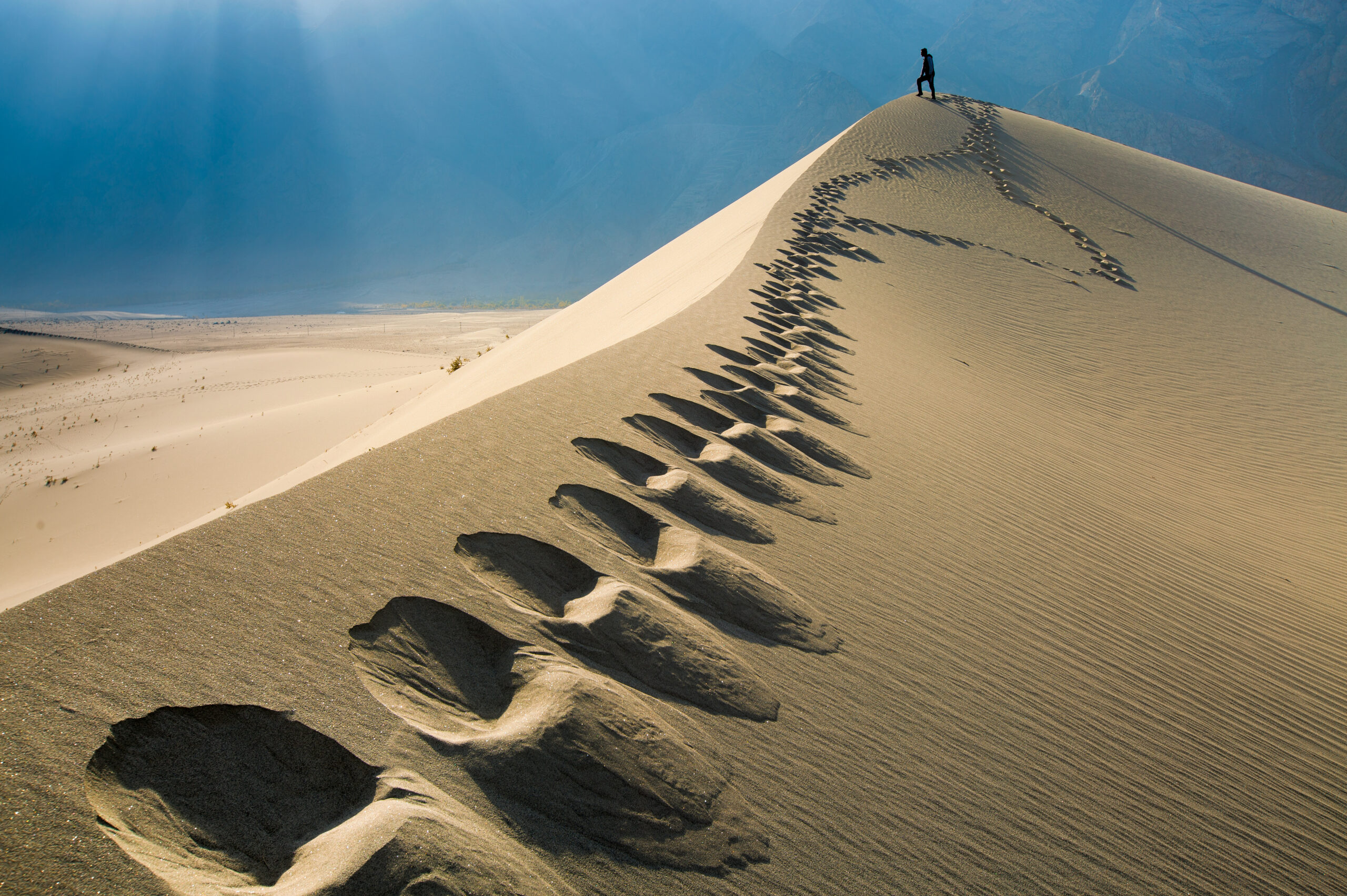
Near Skardu and Shigar, dunes can be combined with lakes, village walks and fort visits. Wind changes the surface and visibility. Choose a permitted place for walking, and discuss access before arranging a vehicle activity. A cold-desert photo does not justify driving across fragile dunes.
Season, temperature and practical planning
For southern desert heritage, cooler months are generally more comfortable for daytime walking. Summer heat can make exposed fort visits and long drives demanding. In Baltistan, warmer-month road access may be easier, while winter brings cold and possible disruption. Check PMD’s current forecast for your exact bases; one national temperature range would be misleading.
Carry water, shade protection, a warm layer when appropriate and sufficient fuel for the chosen route. Agree meal stops and toilets in advance. Remote areas may have limited phone coverage. Keep your planned day shorter when travelling with children or visitors who need frequent breaks.
Use locally appropriate transport and a driver familiar with the specific route. Desert travel is not the place to improvise an unverified off-road shortcut. Ask about land access, conservation rules and seasonal restrictions. Take all waste back to an established disposal point.
For a broader route, read our historical places guide, culture guide and northern destination guide. The heritage gallery adds visual context.
Frequently asked questions
Are there exactly five deserts in Pakistan?
Lists depend on classification and whether smaller dune fields are counted separately. This guide compares five useful travel landscapes rather than asserting an official total.
Where is Derawar Fort?
In Cholistan, southern Punjab. Bahawalpur is a useful base for planning access.
Are Katpana and Sarfaranga the same place?
They are distinct dune areas in the Skardu–Shigar region. Confirm the intended location with your driver.
Can I visit Kharan like Cholistan?
They have different security, permission and service conditions. Current official advice against travel to Balochistan must be considered before any planning.
People · Places · Purpose
Plan a journey around your interests
Tell us your dates, starting point and preferred pace. We will discuss a private route with realistic travel days and appropriate local support.
Discuss your private journey →Sources and updates
Geographical and historical references are linked below. Suggested pacing and travel allowances are Crossroads planning guidance. Reconfirm road access, permissions, opening times and prices before travel.