Crossroads field guides · Destination guides
Hunza is best experienced as a sequence of distinct settlements and landscapes, rather than a single mountain viewpoint. A journey can begin with the forts and lanes of Central Hunza, cross into neighbouring Nagar for glacier scenery, and continue through Attabad toward the Wakhi villages of Upper Hunza. The rewards include architecture, orchards, living languages, local food and walking routes as well as the great Karakoram peaks.
This Hunza Valley travel guide explains the geography, principal places to visit, realistic itinerary choices and practical considerations for different seasons. Travel times are broad planning allowances for private transport and ordinary conditions, not guaranteed schedules. Weather, roadworks, photography stops and your precise hotel location change the day. Site charges, road access and transport availability should be confirmed for your actual dates.
Crossroads Adventure · Editorial review: 6 October 2026
Understand the geography before choosing your hotels
Hunza lies in Gilgit-Baltistan in northern Pakistan, along the Hunza River and the Karakoram Highway. The name is commonly used for a much wider travel area than the historic settlement at Karimabad. Central Hunza and Upper Hunza, also known as Gojal, offer different experiences and deserve separate consideration. Neighbouring Nagar is another district and historical valley community, even though its attractions are often included in a Hunza itinerary.
Karimabad is a strong base for heritage and valley views. Aliabad is the commercial and administrative centre, useful for practical services. Altit and Ganish are distinct settlements with their own histories and buildings. Moving north, the route passes Attabad Lake and continues toward Shishkat, Gulmit, Ghulkin, Hussaini and Passu. Farther along the highway are Sost and the approach toward Khunjerab.
A single hotel can work for a short stay, but Central Hunza and Upper Hunza are not interchangeable bases. Staying several nights only in Karimabad means repeated driving if most of your interests are around Passu and Ghulkin. A split stay gives more time for morning and evening walking, photography and village visits. It also reduces the pressure to fit every Upper Hunza activity into one long excursion.
| Area | Good reasons to stay | Consider before booking |
|---|---|---|
| Karimabad and nearby Central Hunza | Baltit, Altit, Ganish, orchards and broad mountain views | Some hotels involve steep access or stairs |
| Duikar | Elevated valley views and early or late light | Higher, cooler setting and additional driving to the highway |
| Attabad and Shishkat | Lakeside landscape and a position between Central Hunza and Gojal villages | Check room position and access to the shore |
| Gulmit, Ghulkin and Passu area | Wakhi village life, glacier approaches and Upper Hunza walking | Facilities vary by property; allow separate heritage time in Central Hunza |
| Sost | Border-related logistics and access toward northern side valleys | Choose it for a clear route purpose rather than scenery alone |
How to get to Hunza
Fly to Gilgit, then continue by road
Gilgit is the nearest principal air gateway used for a Hunza journey. A flight from Islamabad followed by a road transfer can save substantial overland time, but the entire day still needs to include check-in, baggage collection and the drive. Confirm the operating airline’s current schedule and baggage allowance. The official PIA website provides its own booking information; published route assumptions should never replace a current flight search.
Allow roughly two to three hours or more from Gilgit to a Central Hunza hotel as a private driving margin, depending on stops, road conditions and the exact property. A Rakaposhi viewpoint stop can make the transfer part of the journey rather than a purely logistical stage. Keep the first afternoon adjustable in case the flight operates late or the road takes longer than expected.
Mountain flights can be disrupted. Decide in advance how a cancellation would be handled and who pays for additional transport or overnight accommodation. An alternative flight is not automatically available on the next convenient date. A road contingency needs enough time and a suitable vehicle. Clear arrangements protect the journey better than describing domestic air travel as completely dependable.
Overland from Islamabad
An overland journey provides an introduction to Pakistan’s changing landscapes, but Hunza is a distant destination from Islamabad. A comfortable private itinerary normally breaks the journey into stages. The best overnight point depends on the selected road and current conditions; it should not be chosen simply because it appears halfway along a map.
The Naran–Babusar approach is seasonal. Snow and road conditions determine whether the pass can be used, and access can change around the shoulder seasons. Discuss the Karakoram Highway alternative when Babusar is unavailable. For autumn or spring departures, do not promise the high-pass route until it has been checked close to travel. A longer driving allowance may be necessary when using an alternative.
For visitors combining Hunza with Skardu, dedicate a full day to the regional transfer and keep the arrival programme modest. Do not describe the two regions as nearby day-trip alternatives. They complement each other culturally and geographically, but adding both to a brief programme without enough nights can turn the journey into a series of hotel changes.
Plan to reach Islamabad at least the day before an international flight. Consider more contingency time where a disruption would be especially costly. The final Islamabad day can be used for sightseeing or rest if transport operates normally, and provides space for adjustment if the mountain section changes.
Central Hunza: forts, settlements and landscape history
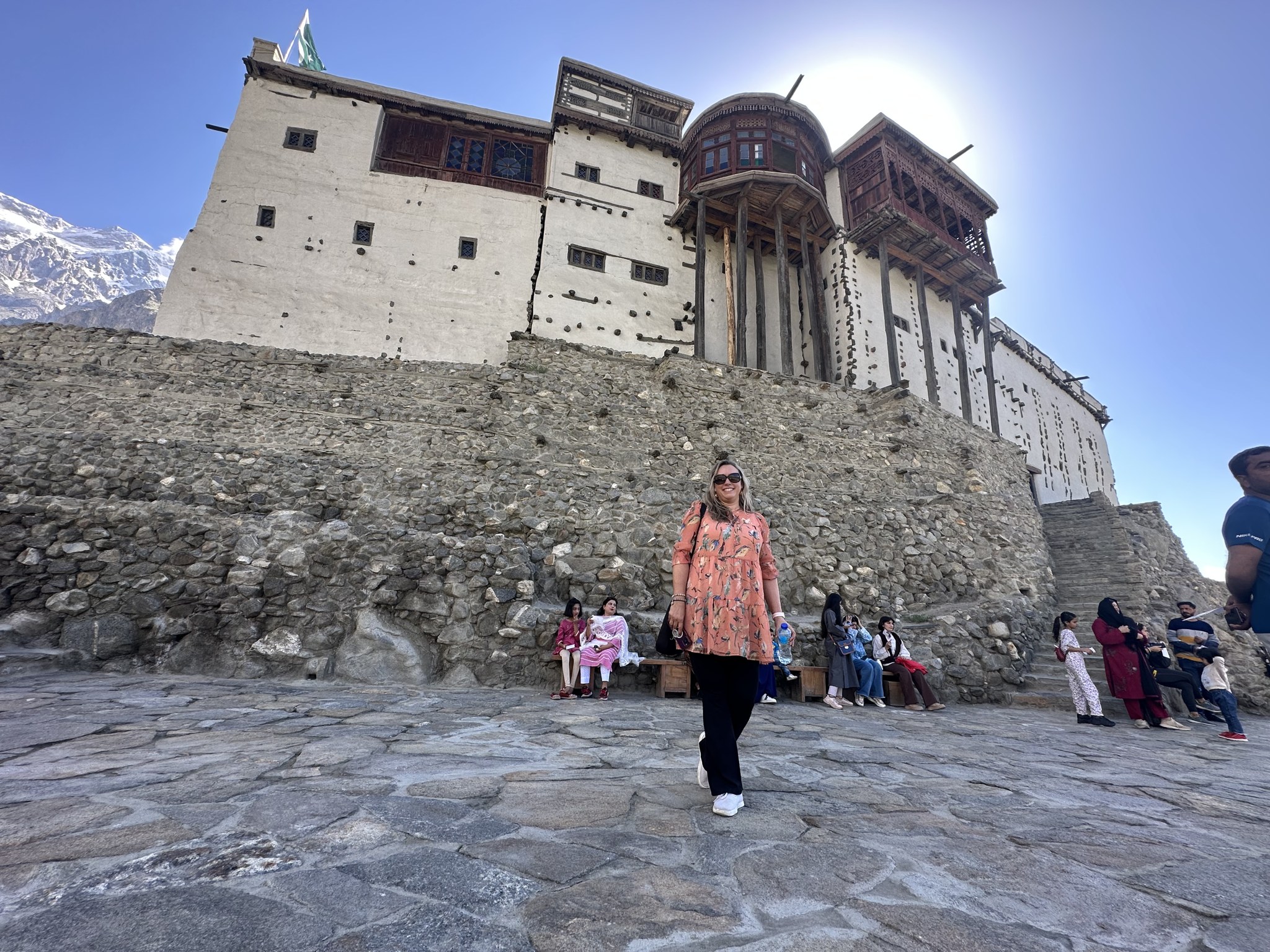
Baltit Fort in Karimabad
Baltit Fort occupies a commanding position above Karimabad. Its location helps explain the relationship between settlement, cultivated land and mountain routes. The building developed over time, so a simple claim that it was built in one year understates its history. The UNESCO Tentative List entry describes its strategic position and historical control of seasonal trans-Karakoram trade.
Baltit is on UNESCO’s Tentative List; that is different from inscription as a World Heritage Site. It was conserved through a major heritage programme and is now interpreted as a museum. A guided visit is valuable for understanding its rooms, defensive setting, construction and later alterations. See the AKDN conservation account for the wider restoration context.
The approach through Karimabad includes uphill walking. Allow approximately an hour or more for the fort interpretation, with additional time for the approach, village lanes and views. This is a planning margin, not a published opening schedule. If someone has difficulty with slopes, discuss the nearest practical vehicle drop-off and the remaining walking before confirming the visit.
Combine the fort with slow exploration of the settlement rather than rushing straight back to the highway. Shops, houses, cultivated terraces and the surrounding paths help place the building in a living community. Ask permission before entering private areas. A viewpoint photograph records the exterior; a good visit also explains how people used the building and how its conservation relates to the town today.
Altit Fort and village
Altit is a separate heritage visit, not an alternative name for Baltit. The fort and its older settlement have a different character and river-facing setting. AKDN’s heritage programme included conservation of Altit and surrounding public space, while the official tourism destination entry identifies it as a principal Hunza attraction. See Altit Fort destination information.
Give the visit enough time for both architecture and village context. The narrow passages, structural timber and relationships between houses can be more informative when explained by someone familiar with the settlement. Restoration awards recognise conservation work; they should not be confused with UNESCO World Heritage inscription. Confirm visitor hours and access arrangements before travelling.
A short village walk can be adapted to the party’s mobility. Religious buildings and courtyards require permission, and ordinary household activity should not be interrupted for a photograph. If you want a hosted cultural encounter, arrange it beforehand and make sure the hosts receive a fair payment for their time. A spontaneous welcome does not create an obligation to receive every visitor.
Ganish and the rock-carving landscape
Ganish offers another perspective on Hunza’s settlement history. Its historic fabric is recognised by Pakistan’s Department of Archaeology and Museums in the Ganish Old Settlement entry. The official regional destination page provides visitor context.
Arrange an appropriately guided walk through permitted areas rather than treating the settlement as a freely accessible architectural display. Ask about communal spaces, older houses, religious buildings and water management. Buildings may be in use, and conservation does not remove the rights of residents to privacy. Follow local instructions about entry and photography.
Hunza’s rock carvings and inscriptions, including the Haldeikish area, connect the valley with older movement through the mountains. Visit with someone who can identify accessible, appropriate viewing areas and explain what is established about the material. Never climb on, scrape, chalk or wet carvings to make a photograph clearer. If access beside a road is unsafe, explanation from a safe location is preferable to an improvised crossing.
Mountain viewpoints: what you are actually seeing
Duikar and the valley panorama
Duikar, often associated with the Eagle’s Nest name, is an elevated settlement above Central Hunza. It is useful for understanding the valley’s scale and the arrangement of peaks and cultivated slopes. The official Duikar entry describes the viewpoint setting. Road access and a short final walk may both be involved depending on the chosen viewpoint.
Sunrise and sunset visits require practical preparation. Confirm the day’s light times locally, leave enough margin for the road and bring warm layers and a torch where an early or late walk is planned. Cloud can hide some or all of the mountains. Do not promise a complete panorama, and avoid standing close to an edge to reproduce a photograph seen online.
A guide can distinguish Rakaposhi, Diran and the mountains on the Hunza side when conditions permit. Knowing which valley and ridge you are looking toward makes the experience more meaningful than a list of peak names. A relaxed visit after the forts can also suit people who prefer scenery to another long drive.
Rakaposhi and neighbouring Nagar
Rakaposhi rises to 7,788 metres in the Karakoram, as recorded by GB Tourism’s Rakaposhi page. Roadside views on the Hunza approach make it unusually accessible as a landscape experience. Viewing the mountain from the highway and trekking to its base camp are very different activities.
Nagar deserves its own identity in a Hunza journey. Minapin is a starting point for the Rakaposhi Base Camp approach, while Hoper provides access to a different glacier landscape and routes toward Rush Lake. A scenic Hoper visit does not automatically involve crossing a glacier. The official Nagar overview identifies these separate walking and sightseeing interests.
Reserve a dedicated day when you want to explore Nagar carefully. The time required depends on the particular village, road and amount of walking, so your route should distinguish a viewpoint excursion from a trekking day. Local agricultural activity, houses and community history are also reasons to visit, rather than treating Nagar simply as a platform for photographs of mountains.
Attabad and Upper Hunza: go beyond the highway stops
Attabad Lake
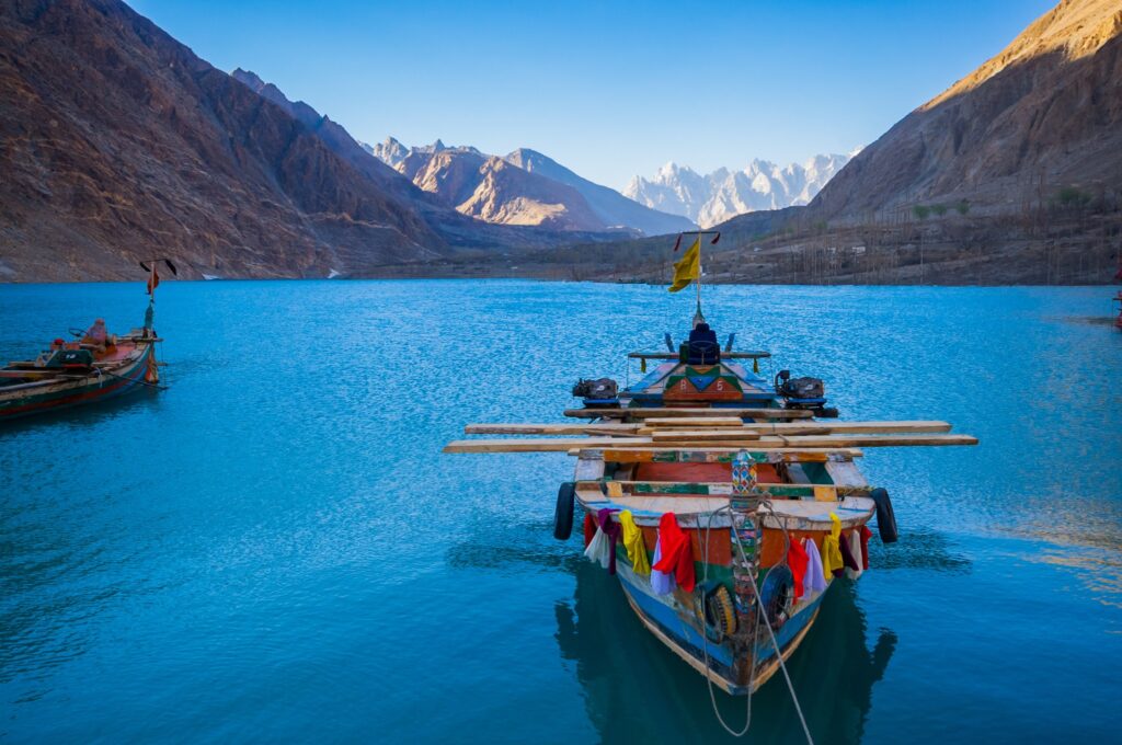
Attabad Lake formed after a landslide blocked the Hunza River in January 2010. NASA’s contemporary satellite account documents the lake’s formation and its effects on homes and movement through the valley. Its beauty today should be understood alongside the disruption experienced by affected communities.
The lake is a worthwhile stop between Central Hunza and Gojal. Decide whether the purpose is a viewpoint, lakeside time, a meal or boating; they do not all have to be combined. For a boat activity, confirm the operator, appropriate life jackets, loading and current conditions. Children’s jackets should fit properly. Optional water activities should be clearly identified in the quotation, with any extra charges explained before arrival.
Water colour, reflections and the atmosphere vary with season, light and weather. An old photograph is not a guarantee of a particular turquoise shade. Lakeside hotels also differ in their actual view and shoreline access, so check the specific room and property rather than booking solely from a destination label.
Gulmit and Shishkat
Gulmit is an important base for experiencing Gojal beyond its roadside panoramas. A carefully arranged walk can include village lanes, agricultural land, local heritage and community enterprises where visits are welcomed. Ask which activities are available on the actual day; workshops, museums and hosted encounters should not be promised without confirming their opening and the hosts’ availability.
Shishkat is another settlement in the lake landscape, with its own community and cultivated surroundings. Allow some time outside the vehicle to observe how people live with the changing mountain environment. Do not label every Gojal village identically: language, household history and settlement experience have local variations even where communities share a broader regional identity.
Ghulkin, Borith and Hussaini
Ghulkin is a village and agricultural landscape, not simply a name attached to a glacier. A guided village walk can explain irrigation, orchards and paths connecting neighbouring settlements. Permission is important when walking through fields, especially during cultivation and harvest. If the route includes glacier terrain, that must be described explicitly as a trekking activity with appropriate local support.
Borith Lake offers a quieter landscape above the main highway. It can be combined with a suitable local walk or viewpoint, depending on access and the party’s ability. The official Borith entry identifies the destination. Do not assume that a walk from one nearby settlement to another remains unchanged from year to year where glacier margins or tracks affect access.
Hussaini is known for its suspension bridge and riverside setting. The bridge should be approached as an optional activity, not a compulsory test of courage. Check current local conditions and instructions, and allow anyone to remain at a safe viewing location. Photographs do not establish structural condition or suitability for a particular person. The official Hussaini village page also places the settlement within the wider Gojal landscape.
Passu: village, cones and glaciers
Passu’s distinctive pointed skyline is among the Karakoram’s most recognisable landscapes. It is not the same as a view of K2, and the cones should not be assigned an invented summit name or altitude simply to strengthen a caption. The official Passu village description connects the settlement with its mountain setting and living Wakhi traditions.
Give Passu more than a roadside stop. A village walk, time beside permitted agricultural paths and a properly selected viewpoint reveal different aspects of the place. Ask permission for portraits and avoid stepping into crops to align a photograph. Early or late light can be rewarding, but use designated parking and safe roadside locations rather than standing in the highway.
Passu and Batura glacier experiences need careful distinctions. Viewing a glacier from a safe approach is different from stepping onto ice or crossing debris-covered terrain. The latter requires a current route assessment, capable guides and suitable equipment. A glacier can look like ordinary rocky ground while concealing unstable features. Do not follow a route from an old online track without local confirmation.
Khunjerab: high-altitude excursion or border journey?
Khunjerab Pass lies at approximately 4,693 metres, a height recorded in the Trade Development Authority of Pakistan destination guide. An excursion from Upper Hunza involves a substantial road day, high altitude and a national-park setting. It should be planned for its own interest, rather than automatically added to every journey.
Confirm current visitor access, road conditions, documentation requirements and applicable charges through the relevant authorities or your organiser. Conditions at the pass can be very different from those at your hotel. Carry warm clothing and avoid assuming that a quick vehicle visit has no altitude implications. Wildlife sightings are possible in the wider park landscape but cannot be guaranteed.
A sightseeing visit near the pass is not the same as crossing into China. International border travel requires appropriate visas, transport and immigration arrangements, which need separate verification. Sost is an important logistical settlement for that purpose. Do not design a cross-border itinerary around a general article’s description of visitor access.
Choose walking routes by effort, altitude and terrain
Hunza supports everything from a short village stroll to a demanding multi-day trek. The word easy is insufficient on its own. Ask about walking hours, ascent, highest point, sleeping altitude, exposed sections, glacier crossings and the surface underfoot. A path with little climbing may still be unsuitable for someone uncomfortable with narrow footing.
| Experience | Main character | Planning requirement |
|---|---|---|
| Karimabad, Altit or a hosted village walk | Heritage, lanes, orchards and local explanation | Adapt slopes and duration to the party |
| Gulmit and nearby viewpoints | Village context and additional uphill walking where chosen | Confirm the exact path and remaining steps |
| Ghulkin–Borith walking options | Village and mountain landscapes; some variants involve glacier terrain | Name the chosen route and arrange qualified local support |
| Rakaposhi Base Camp | Substantial ascent from Minapin toward high mountain scenery | Dedicated trekking plan, fitness and appropriate overnight arrangements |
| Rush Lake | Multi-day high-altitude walking from the Hoper area | Altitude preparation, glacier-route support and camping logistics |
| Patundas | High pasture above Upper Hunza with glacier approaches | Local guide, camping plan and route-specific equipment |
| Shimshal extensions | Remote valley and multi-day pasture or pass routes | Separate time allocation, transport and trekking support |
Patundas is a pasture belonging to Ghulkin village. Typical camping is around 4,200 metres, with an optional higher endpoint around 4,600 metres depending on the chosen route and conditions. These are not the same altitude, and an itinerary should state clearly which point it reaches. Adding a Ghulkin glacier walk is an additional route decision, not something to include silently within a short sightseeing description.
Read the detailed short treks in Hunza and Nagar guide, Patundas trekking guide and Shimshal Valley trekking guide when comparing options. A destination guide helps select a route; it does not replace the detailed preparation needed for glacier crossings, remote camping or substantial altitude gain.
When is the best time to visit Hunza?
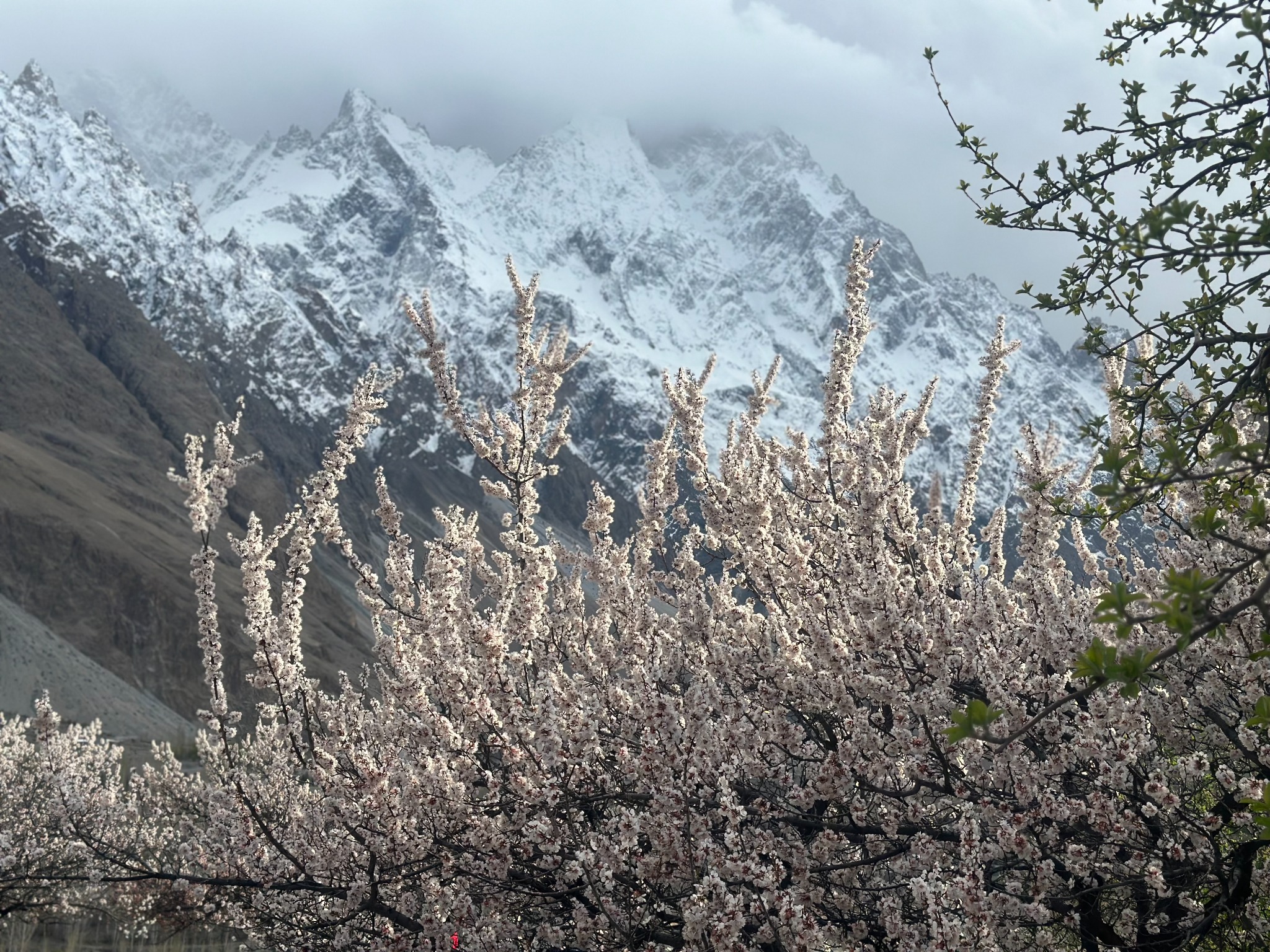
The best season depends on the purpose of your journey. Spring suits blossom and village photography, summer offers the usual period for many higher walking routes, and autumn highlights orchards and tree colour. Winter can be rewarding for a carefully arranged lower-valley visit, but services, heating and transport deserve extra attention. There is no single month that guarantees every attraction and activity.
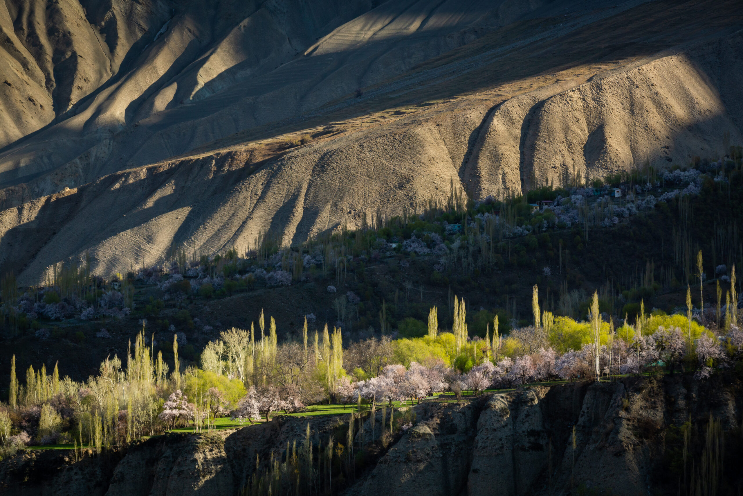
Blossom commonly progresses through different elevations during spring rather than appearing everywhere at once. Use a flexible late-March-to-April planning window for many orchard-focused journeys, with the understanding that actual flowering can be earlier or later. Apricot, cherry, apple and other trees do not all share the same timing. A current local report is more useful than selecting an exact peak week from a photograph. The spring blossom guide explains how to plan across Hunza, Nagar and Baltistan.
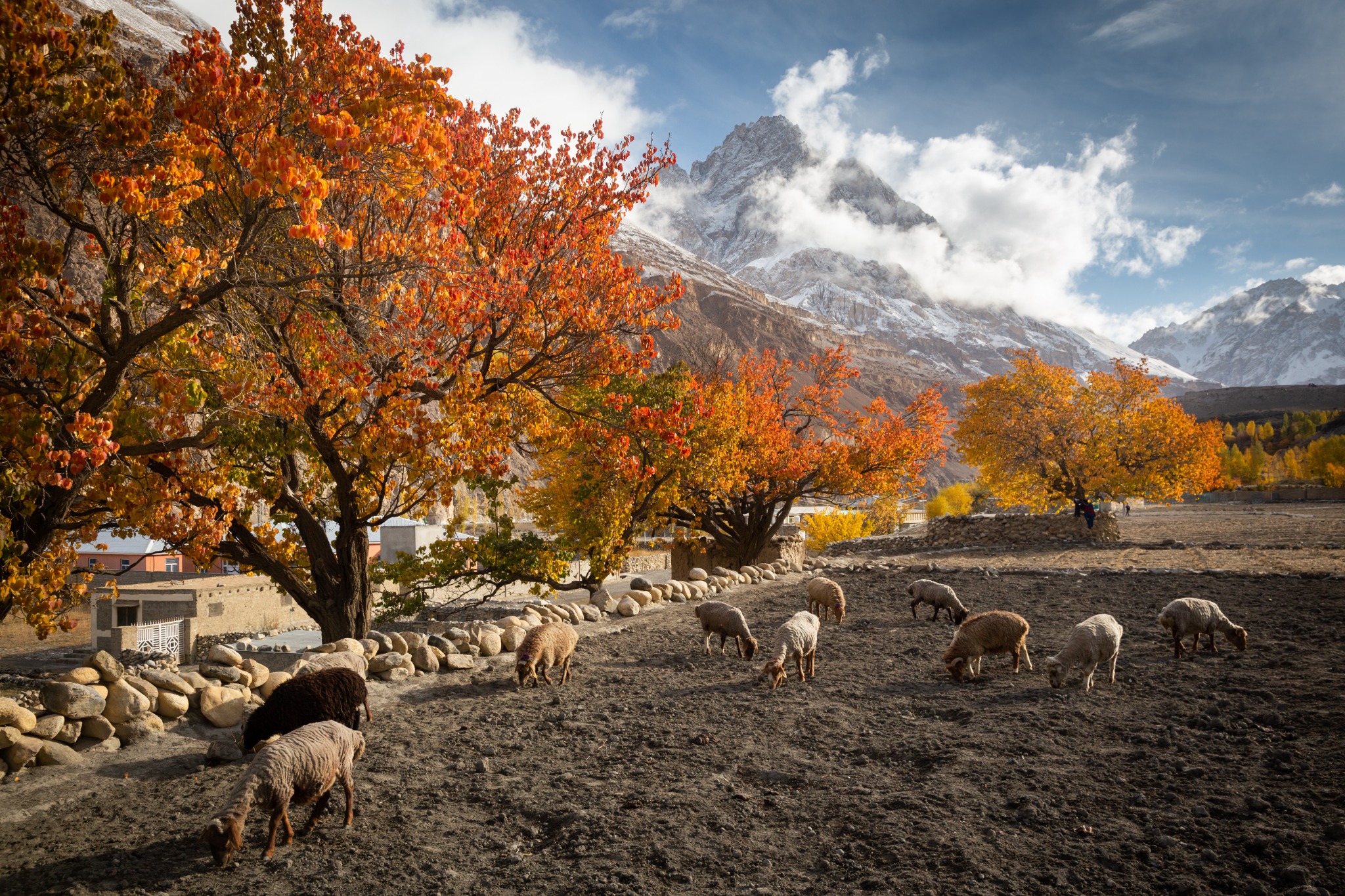
Autumn colour often makes October a useful planning period, with variation into neighbouring weeks according to locality and conditions. Higher villages, lower terraces, different tree species and the season’s weather may show different stages on the same day. Late autumn also brings colder nights and increased uncertainty for high roads and camping. Do not assume that good orchard colour means a remote trek remains appropriate. Read our autumn in Hunza and Skardu guide for location choices, photography and seasonal route planning.
Use actual forecasts for the places and elevations on your route. A comfortable afternoon in Karimabad does not describe Khunjerab, a windy glacier approach or a high camp after sunset. Layered clothing, sun protection and a warm outer layer are sensible across seasons. For blossom and autumn stays, confirm room heating and hot-water arrangements instead of relying only on a hotel’s star description.
People, food and respectful cultural encounters
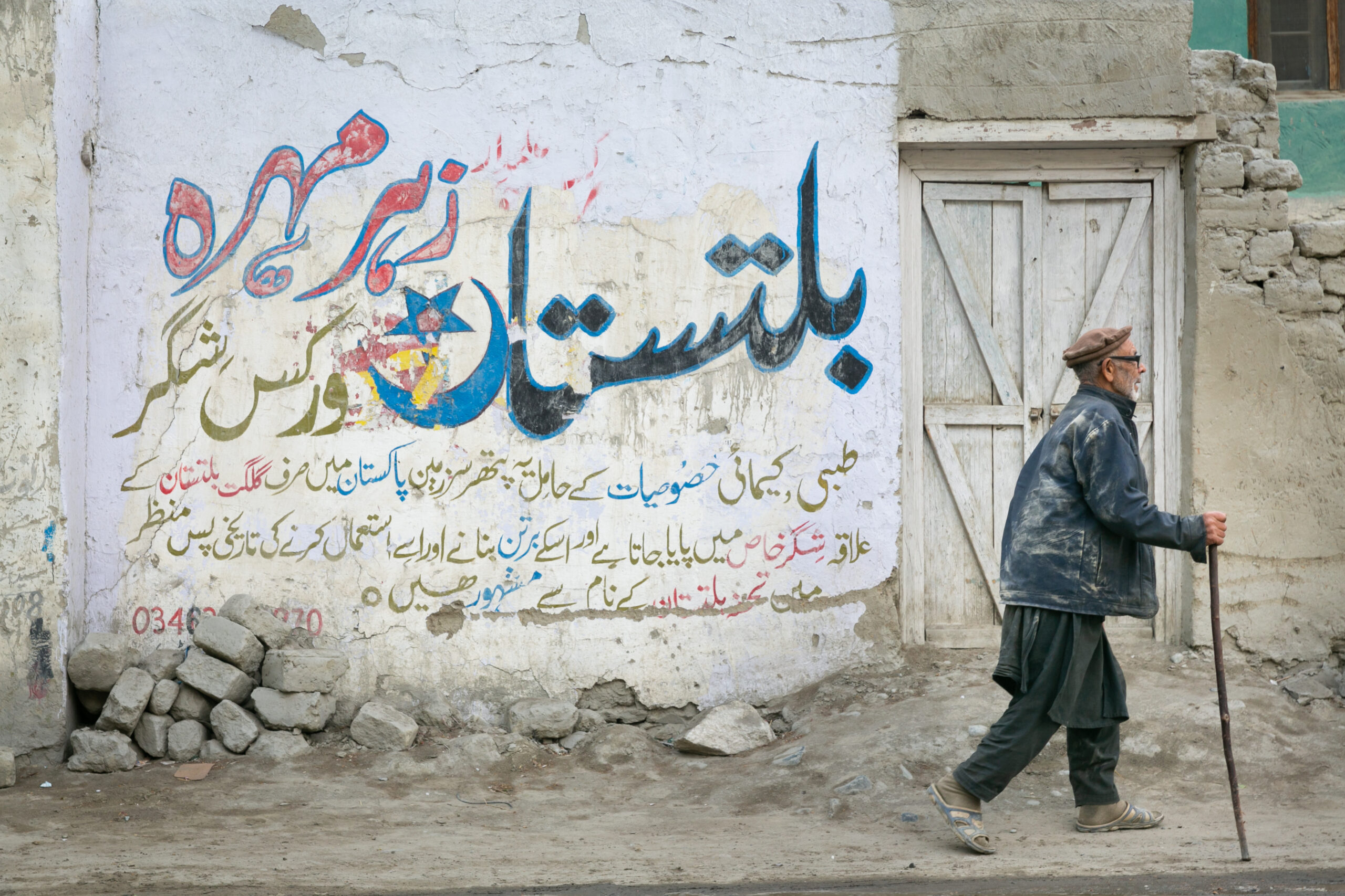
Hunza is linguistically diverse. Burushaski is central to many Central Hunza communities, Wakhi is widely associated with Upper Hunza, and Shina also forms part of the wider regional language landscape. A language label should not be used to predict every person’s background. Ask how residents identify their own community, and let a knowledgeable local guide explain differences without reducing them to stereotypes.
Food offers a direct connection with household and agricultural life. Dishes such as chapshuro, local breads and preparations using apricot or walnut ingredients can be interesting introductions, but recipes and names vary. Arrange a meal with dietary requirements clearly stated. A hosted family meal should be organised fairly, with consent and payment, rather than treated as something residents are expected to provide spontaneously.
Orchards, channels and fields are working spaces. Blossom photographs should not involve breaking branches or entering private land uninvited. During harvest, avoid interfering with work; if a visit has been arranged, let the host decide how guests can participate. Purchasing local produce, crafts or a guided explanation can support the people whose landscape you are enjoying.
Ask before taking close portraits, particularly of children. Permission from a guide is not a substitute for the person’s consent. Religious spaces require appropriate clothing and behaviour, and some may not be open to casual visitors. Drone use needs applicable permissions and respect for privacy, airspace and local restrictions. Do not fly over a settlement simply because there is a clear view from above.
Claims that all Hunza residents live exceptionally long lives, never become ill or follow one miraculous diet should not be repeated as fact. The valley’s people deserve accurate representation rather than health mythology. A more useful conversation concerns education, farming, language, architecture, community organisation and the changes residents see in their own lives.
How many nights should you spend in Hunza?
Three regional nights allow only a selective introduction. Prioritise Central Hunza heritage and one Upper Hunza excursion, and accept that there will be limited time for walking or weather flexibility. Arrival and departure days may not be full sightseeing days. Do not interpret a three-night stay as three complete days available for distant visits.
Five to seven regional nights support a more balanced journey. Spend two or three nights in Central Hunza for Baltit, Altit, Ganish, a viewpoint and a Nagar visit. Then move into Upper Hunza for village walks, Attabad and Passu landscapes. Add Khunjerab only when it suits the group’s interests, current access and health considerations. A photography programme may use an additional night to revisit a landscape in better light.
Trekking extensions require additional days beyond this sightseeing outline. Shimshal deserves a separate allocation for the road and the intended walks. Rush Lake or Patundas needs a route-specific camping schedule and contingency. Do not squeeze a multi-day trek between two hotel transfers without time to prepare, recover or respond to weather.
Choose hotels by actual facilities and location. Confirm the room category, view, heating, stairs, vehicle access and distance from planned visits. Premium accommodation is available in selected locations, while more remote extensions may use simpler lodges or camping. A clear programme describes these differences instead of implying that the same standard exists throughout the mountains.
Clarify inclusions before booking: private transport, guide, accommodation, meals, domestic flights, boat activities, entrance charges and trekking support are separate items. In a standard private sightseeing journey, breakfast may be included while other meals remain separate. Trekking days can require another meal arrangement. Ask how additional transport is charged if a domestic flight is cancelled, and keep optional activities clearly identified.
Carry cash for smaller purchases, keep essential documents and contact information available offline, and confirm communication arrangements on remote extensions. Mobile coverage and internet quality vary. Use a qualified local organiser for route assessment and logistics where glacier terrain, high altitude or restricted areas are involved. The most productive enquiry gives dates, available nights, walking ability and the kind of experience you want.
Hunza Valley: frequently asked questions
Should I stay in Karimabad or Upper Hunza?
Karimabad suits Central Hunza heritage and views. Upper Hunza suits Gojal village life, Passu landscapes and nearby walking. A split stay is often the most useful choice when you have five nights or more.
Is Nagar part of Hunza?
Nagar is a separate neighbouring district and historical valley community. Its attractions are often combined with Hunza journeys, but should be identified accurately.
Can you see K2 from Hunza?
Do not expect K2 from the usual Hunza highway or village viewpoints. Hunza’s great mountain scenery includes other Karakoram peaks; a K2 Base Camp expedition belongs to a different itinerary through Baltistan.
Do I need to cross a glacier to enjoy Upper Hunza?
No. Village walks, lake visits and suitable viewpoints offer a rewarding experience. Glacier crossings are separate activities needing qualified support and a current route assessment.
Is a visit to Khunjerab the same as crossing into China?
No. A sightseeing excursion and an international border journey involve different documentation, access and transport arrangements. Verify the applicable rules for your intended activity.
Can the exact blossom or autumn peak be guaranteed?
No. Timing changes by species, elevation and weather. A flexible route with several days and current local observations improves your chances of finding attractive conditions.
Can I fly back from Gilgit on my international departure day?
Plan to reach Islamabad at least the previous day and consider more contingency time if necessary. Discuss flight disruption arrangements before the mountain section begins.
Sources and planning notes
Heritage and destination context have been checked against Gilgit-Baltistan Tourism, UNESCO’s Baltit Tentative List entry, AKDN and the linked NASA account of Attabad. Suggested night distributions and driving allowances are editorial planning guidance. Obtain fresh site, transport, road and route information for your actual dates.
Continue exploring northern Pakistan
Plan your northern Pakistan journey
Share your dates, interests, walking ability and preferred pace. Crossroads Adventure can shape a private journey around the places and experiences that matter to you.
Start planning your journey