The Karakoram Highway is often described as one of the world’s most scenic roads. But to reduce it to scenery alone is to miss its deeper meaning.
This route is not simply a connection between places — it is a continuation of ancient movement. Long before asphalt and borders, variations of the Silk Route passed through these valleys, carrying traders, pilgrims, armies, and ideas between South Asia, Central Asia, and China.
For experienced explorers, traveling the Karakoram Highway is less about reaching a destination and more about following a story that has unfolded for centuries.
Why the Karakoram Highway Is More Than a Scenic Drive
Stretching from Islamabad to the Khunjerab Pass on the Pakistan–China border, the Karakoram Highway passes through some of the most dramatic terrain on Earth.
It moves alongside the Indus River, cuts through deep gorges, skirts glaciers, and climbs steadily into the high mountains of Gilgit-Baltistan. At various points, it passes near the junction of the Karakoram, Himalaya, and Hindu Kush — a geographical convergence found in very few places worldwide.
For travelers who value context, this road reveals how geography dictates settlement, trade, and survival.
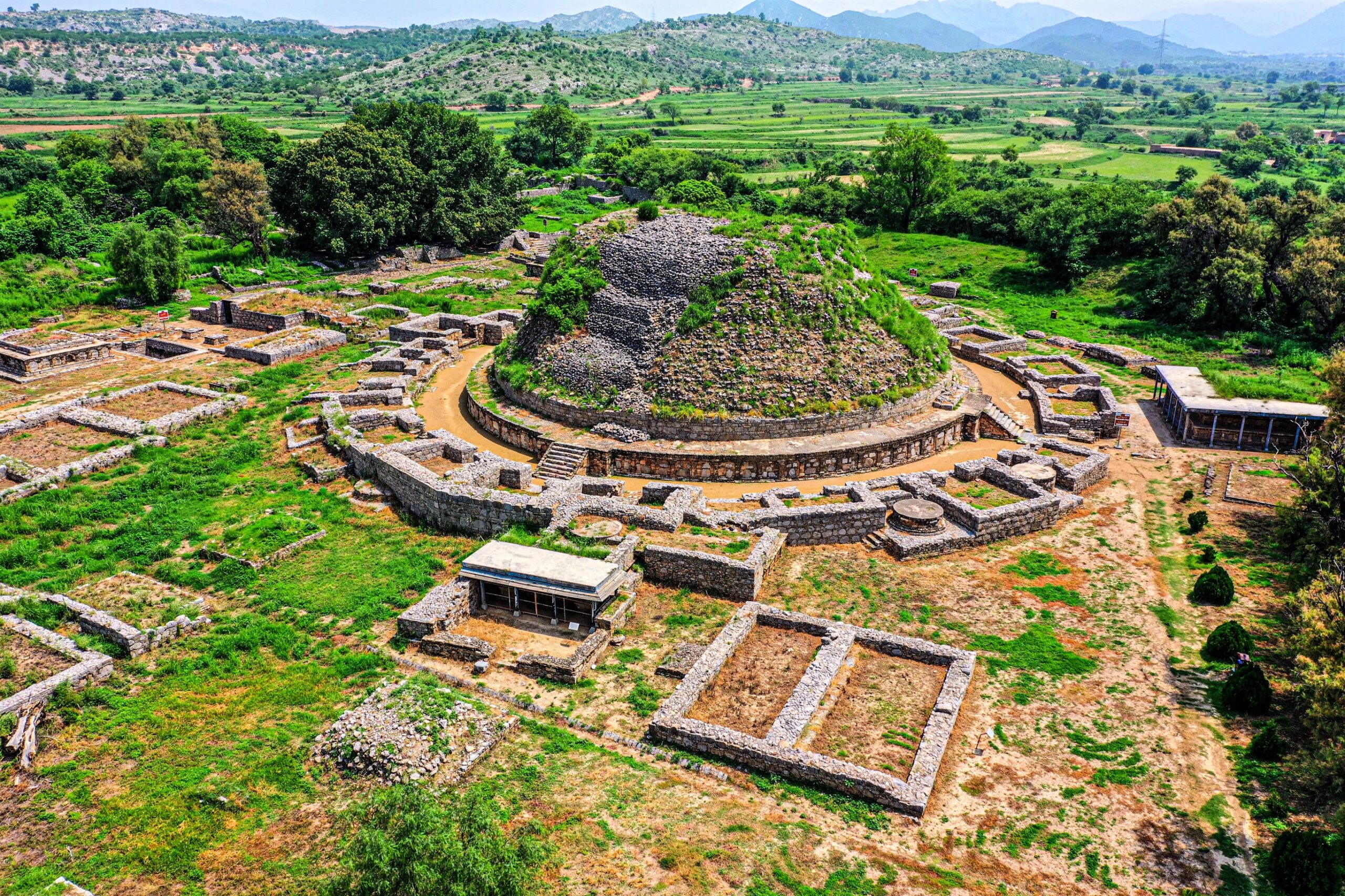
The Ancient Silk Route and the Karakoram Corridor
The modern Karakoram Highway broadly follows paths once used by caravans moving along the ancient Silk Route.
These routes were never singular lines on a map. They were networks — shifting with seasons, politics, and terrain. What remained constant was the necessity of passing through these valleys to connect civilizations.
As you travel this corridor today, villages still sit where caravans once rested, and mountain passes still serve as gateways rather than boundaries. The road feels less like an intrusion and more like an adaptation of something far older.
Traveling the Karakoram Highway Through Hunza and Upper Hunza
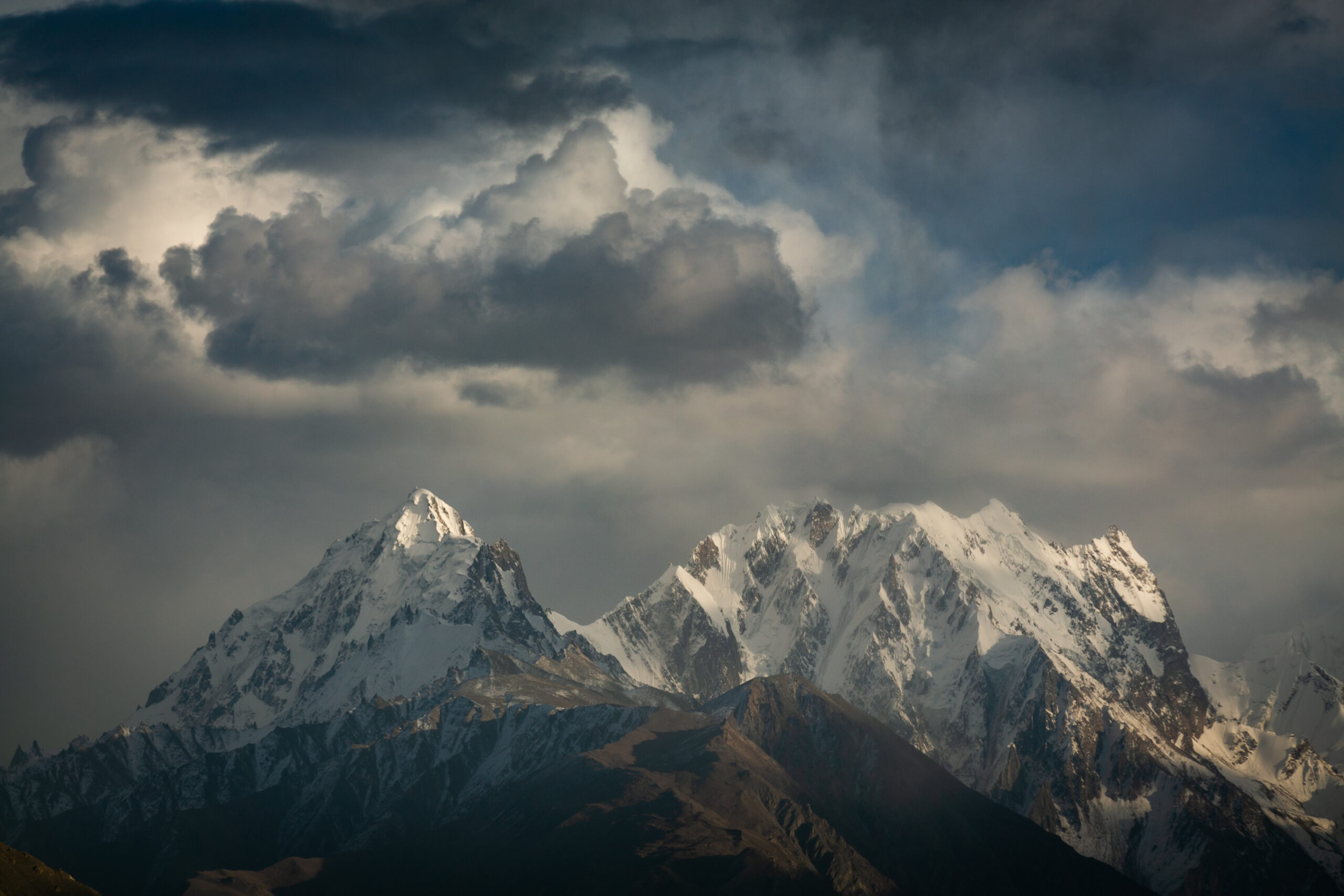
One of the most compelling sections of the Karakoram Highway in Pakistan runs through Hunza Valley and Upper Hunza (Gojal).
Here, the road threads between villages such as Gulmit, Passu, and Karimabad, each shaped by altitude, agriculture, and history. Peaks like Rakaposhi and Passu Cones dominate the horizon, rising almost directly from the valley floor.
For experienced explorers, this stretch rewards those who pause — to walk, to talk, to observe how daily life unfolds in the shadow of immense landscapes.
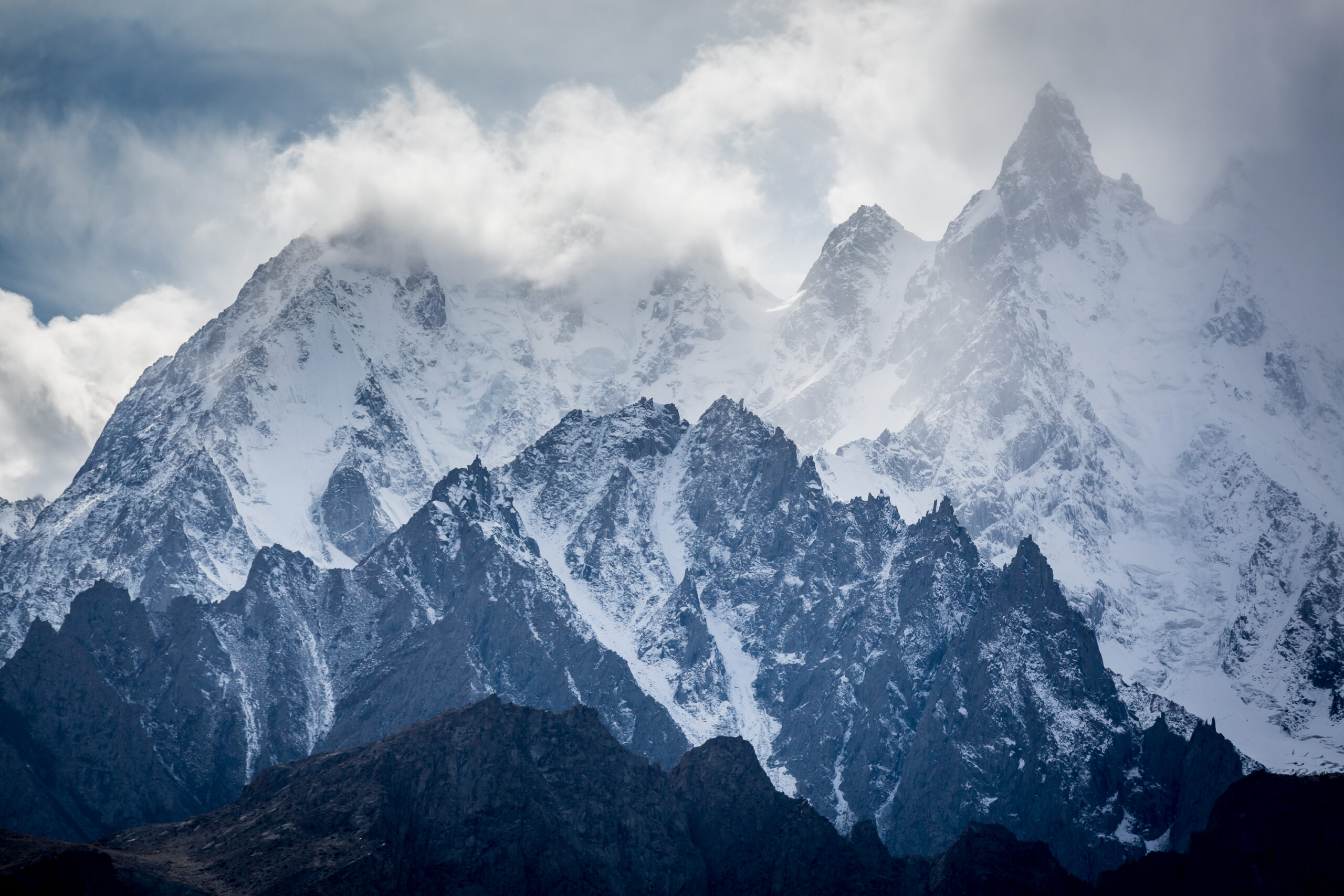
Geography That Shapes the Journey
On the Karakoram Highway, geography is never background.
The Indus River accompanies much of the route, carving deep channels through rock that has been pushed upward by tectonic forces for millions of years. Landslides, glaciers, and seasonal shifts regularly remind travelers that this is a living landscape.
Journeys here must be designed with flexibility. Weather can alter plans. Roads may close temporarily. Progress is measured not in speed, but in attentiveness.
Seasoned travelers often appreciate this honesty.
Is the Karakoram Highway Safe for International Travelers?
A common question among those planning Pakistan travel is whether the Karakoram Highway is safe.
For informed and well-prepared travelers, the answer is generally yes. The route is widely used, particularly in Gilgit-Baltistan, and is considered one of the safer regions for international visitors.
Safety along the Karakoram Highway depends on:
- choosing the right season
- allowing buffer time for weather or road conditions
- traveling with local insight
- avoiding rushed itineraries
As with much of Pakistan, safety here is a function of preparation rather than avoidance.
The Best Time to Travel the Karakoram Highway
The best time to travel the Karakoram Highway is typically between April and October, depending on elevation and weather.
- Spring (April–May): Roads reopen, landscapes awaken, fewer crowds
- Summer (June–August): Full access to high-altitude areas, though weather can be variable
- Autumn (September–October): Clear skies, stable conditions, and exceptional mountain visibility
Winter travel is limited due to snow and road closures at higher elevations.
Experienced explorers often prefer shoulder seasons, when the road feels quieter and more reflective.
Why the Karakoram Highway Appeals to Experienced Explorers
For those who have traveled widely, the Karakoram Highway offers something increasingly rare: a journey where infrastructure has adapted to the land, not reshaped it entirely.
There are no shortcuts here. The road follows rivers, respects valleys, and negotiates mountains rather than dominating them. Progress feels earned, not granted.
For seasoned travelers, this makes the journey feel authentic rather than staged.
Final Thoughts: A Road That Carries Memory
The Karakoram Highway is not a road you rush through. It asks to be experienced with patience and curiosity.
Following this route is not just about moving through Northern Pakistan — it is about understanding how mountains, rivers, and human movement have shaped one another over time.
For experienced explorers, the Karakoram Highway is less a highlight and more a lens through which Pakistan begins to make sense.
FAQ:
What is the Karakoram Highway?
The Karakoram Highway is a high-altitude road connecting Pakistan and China, running through Gilgit-Baltistan and following parts of the ancient Silk Route.
Is the Karakoram Highway safe for tourists?
Yes. The Karakoram Highway is generally safe for tourists, especially when traveled during the recommended seasons and with proper planning.
What is the best time to travel the Karakoram Highway?
The best time to travel the Karakoram Highway is between April and October, with autumn offering the clearest weather and best visibility.
Does the Karakoram Highway pass through Hunza Valley?
Yes. The highway runs directly through Hunza Valley and Upper Hunza (Gojal), making it a central route for northern Pakistan travel.
Why is the Karakoram Highway historically important?
The highway follows ancient trade corridors of the Silk Route, linking civilizations across Asia for centuries.